You are here: Home > Network List > TA - USArray Transportable Network (new EarthScope stations) Stations List
> Station I16A Newdale, ID, USA > Earthquake Result Viewer
I16A Newdale, ID, USA - Earthquake Result Viewer
*The percent match for this event was below the threshold and hence no stack was calculated.
| Earthquake location: |
Near Coast Of Peru |
| Earthquake latitude/longitude: |
-13.6/-76.6 |
| Earthquake time(UTC): |
2009/02/02 (033) 17:53:21 GMT |
| Earthquake Depth: |
21 km |
| Earthquake Magnitude: |
5.6 MB, 5.6 MS, 6.0 MW, 5.9 MW |
| Earthquake Catalog/Contributor: |
WHDF/NEIC |
|
| Network: |
TA USArray Transportable Network (new EarthScope stations) |
| Station: |
I16A Newdale, ID, USA |
| Lat/Lon: |
43.88 N/111.49 W |
| Elevation: |
1744 m |
|
| Distance: |
65.5 deg |
| Az: |
332.924 deg |
| Baz: |
142.262 deg |
| Ray Param: |
$rayparam |
*The percent match for this event was below the threshold and hence was not used in the summary stack. |
|
| Radial Match: |
75.58852 % |
| Radial Bump: |
379 |
| Transverse Match: |
73.149155 % |
| Transverse Bump: |
346 |
| SOD ConfigId: |
6627 |
| Insert Time: |
2010-03-06 09:03:19.196 +0000 |
| GWidth: |
2.5 |
| Max Bumps: |
400 |
| Tol: |
0.001 |
|
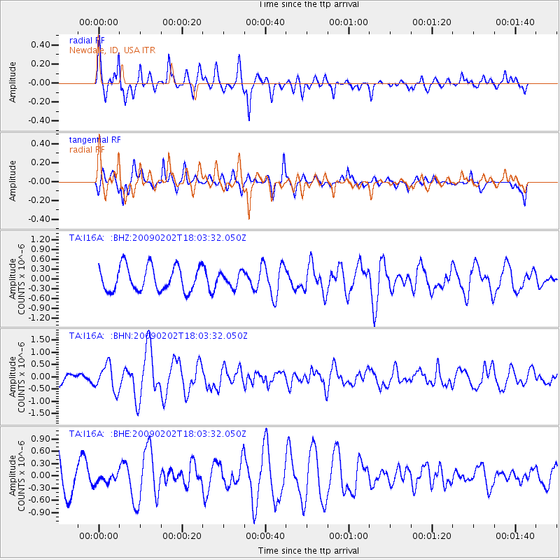
Signal To Noise
| Channel | StoN | STA | LTA |
| TA:I16A: :BHN:20090202T18:03:32.050Z | 1.6541028 | 5.3770816E-7 | 3.2507543E-7 |
| TA:I16A: :BHE:20090202T18:03:32.050Z | 0.332238 | 1.07614035E-7 | 3.2390648E-7 |
| TA:I16A: :BHZ:20090202T18:03:32.050Z | 0.6024431 | 2.2637282E-7 | 3.75758E-7 |
| Arrivals |
| Ps | |
| PpPs | |
| PsPs/PpSs | |


