You are here: Home > Network List > TA - USArray Transportable Network (new EarthScope stations) Stations List
> Station R33M Jennings River, BC, CAN > Earthquake Result Viewer
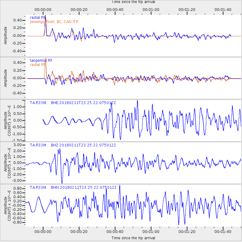
R33M Jennings River, BC, CAN - Earthquake Result Viewer
*The percent match for this event was below the threshold and hence no stack was calculated.
| Earthquake location: |
South Of Mariana Islands |
| Earthquake latitude/longitude: |
13.8/146.5 |
| Earthquake time(UTC): |
2018/02/11 (042) 23:14:18 GMT |
| Earthquake Depth: |
42 km |
| Earthquake Magnitude: |
6.2 Mi |
| Earthquake Catalog/Contributor: |
NEIC PDE/pt |
|
| Network: |
TA USArray Transportable Network (new EarthScope stations) |
| Station: |
R33M Jennings River, BC, CAN |
| Lat/Lon: |
59.39 N/130.97 W |
| Elevation: |
1437 m |
|
| Distance: |
74.4 deg |
| Az: |
31.783 deg |
| Baz: |
270.762 deg |
| Ray Param: |
$rayparam |
*The percent match for this event was below the threshold and hence was not used in the summary stack. |
|
| Radial Match: |
85.41318 % |
| Radial Bump: |
400 |
| Transverse Match: |
69.404785 % |
| Transverse Bump: |
400 |
| SOD ConfigId: |
13570011 |
| Insert Time: |
2019-04-29 19:33:14.804 +0000 |
| GWidth: |
2.5 |
| Max Bumps: |
400 |
| Tol: |
0.001 |
|
Signal To Noise
| Channel | StoN | STA | LTA |
| TA:R33M: :BHZ:20180211T23:25:22.075012Z | 1.8448049 | 4.3046003E-7 | 2.3333635E-7 |
| TA:R33M: :BHN:20180211T23:25:22.075012Z | 1.2635893 | 1.8704381E-7 | 1.480258E-7 |
| TA:R33M: :BHE:20180211T23:25:22.075012Z | 1.5933052 | 2.537117E-7 | 1.5923608E-7 |
| Arrivals |
| Ps | |
| PpPs | |
| PsPs/PpSs | |


