You are here: Home > Network List > TA - USArray Transportable Network (new EarthScope stations) Stations List
> Station I16A Newdale, ID, USA > Earthquake Result Viewer
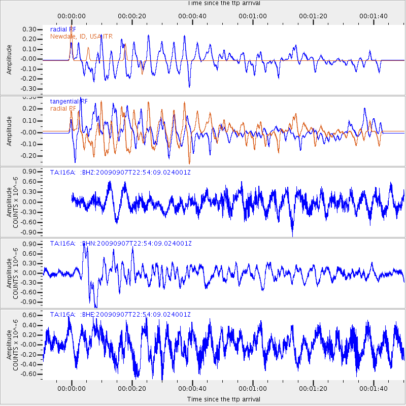
I16A Newdale, ID, USA - Earthquake Result Viewer
*The percent match for this event was below the threshold and hence no stack was calculated.
| Earthquake location: |
Northwestern Caucasus |
| Earthquake latitude/longitude: |
42.7/43.4 |
| Earthquake time(UTC): |
2009/09/07 (250) 22:41:37 GMT |
| Earthquake Depth: |
15 km |
| Earthquake Magnitude: |
5.7 MB, 5.8 MS, 6.0 MW, 5.9 MW |
| Earthquake Catalog/Contributor: |
WHDF/NEIC |
|
| Network: |
TA USArray Transportable Network (new EarthScope stations) |
| Station: |
I16A Newdale, ID, USA |
| Lat/Lon: |
43.88 N/111.49 W |
| Elevation: |
1744 m |
|
| Distance: |
91.0 deg |
| Az: |
342.153 deg |
| Baz: |
18.216 deg |
| Ray Param: |
$rayparam |
*The percent match for this event was below the threshold and hence was not used in the summary stack. |
|
| Radial Match: |
45.09143 % |
| Radial Bump: |
400 |
| Transverse Match: |
48.353252 % |
| Transverse Bump: |
400 |
| SOD ConfigId: |
2622 |
| Insert Time: |
2010-03-06 09:03:38.906 +0000 |
| GWidth: |
2.5 |
| Max Bumps: |
400 |
| Tol: |
0.001 |
|
Signal To Noise
| Channel | StoN | STA | LTA |
| TA:I16A: :BHN:20090907T22:54:09.024001Z | 2.7495353 | 3.499156E-7 | 1.2726353E-7 |
| TA:I16A: :BHE:20090907T22:54:09.024001Z | 1.1654 | 2.872139E-7 | 2.4645092E-7 |
| TA:I16A: :BHZ:20090907T22:54:09.024001Z | 0.98006755 | 2.2358402E-7 | 2.2813124E-7 |
| Arrivals |
| Ps | |
| PpPs | |
| PsPs/PpSs | |


