You are here: Home > Network List > UW - Pacific Northwest Regional Seismic Network Stations List
> Station FISH Seaside, OR, USA > Earthquake Result Viewer
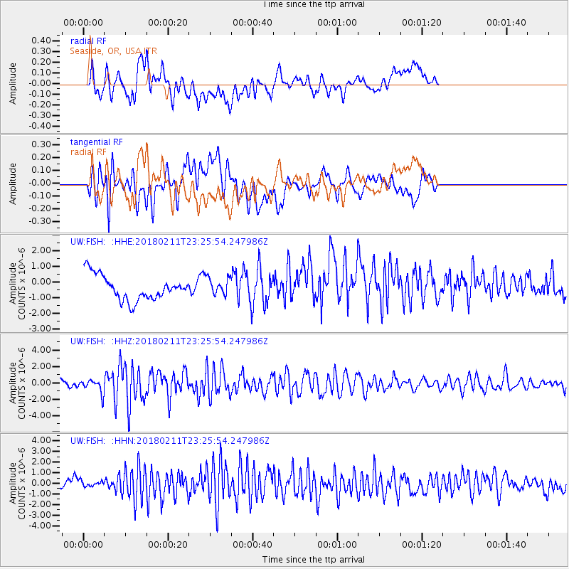
FISH Seaside, OR, USA - Earthquake Result Viewer
*The percent match for this event was below the threshold and hence no stack was calculated.
| Earthquake location: |
South Of Mariana Islands |
| Earthquake latitude/longitude: |
13.8/146.5 |
| Earthquake time(UTC): |
2018/02/11 (042) 23:14:18 GMT |
| Earthquake Depth: |
42 km |
| Earthquake Magnitude: |
6.2 Mi |
| Earthquake Catalog/Contributor: |
NEIC PDE/pt |
|
| Network: |
UW Pacific Northwest Regional Seismic Network |
| Station: |
FISH Seaside, OR, USA |
| Lat/Lon: |
45.93 N/123.56 W |
| Elevation: |
325 m |
|
| Distance: |
80.1 deg |
| Az: |
45.104 deg |
| Baz: |
279.633 deg |
| Ray Param: |
$rayparam |
*The percent match for this event was below the threshold and hence was not used in the summary stack. |
|
| Radial Match: |
55.2093 % |
| Radial Bump: |
400 |
| Transverse Match: |
64.57956 % |
| Transverse Bump: |
400 |
| SOD ConfigId: |
13570011 |
| Insert Time: |
2019-04-29 19:33:56.421 +0000 |
| GWidth: |
2.5 |
| Max Bumps: |
400 |
| Tol: |
0.001 |
|
Signal To Noise
| Channel | StoN | STA | LTA |
| UW:FISH: :HHZ:20180211T23:25:54.247986Z | 3.398236 | 8.366902E-7 | 2.462131E-7 |
| UW:FISH: :HHN:20180211T23:25:54.247986Z | 0.63935786 | 4.14798E-7 | 6.4877275E-7 |
| UW:FISH: :HHE:20180211T23:25:54.247986Z | 0.81998 | 6.6304324E-7 | 8.08609E-7 |
| Arrivals |
| Ps | |
| PpPs | |
| PsPs/PpSs | |


