You are here: Home > Network List > TA - USArray Transportable Network (new EarthScope stations) Stations List
> Station I16A Newdale, ID, USA > Earthquake Result Viewer
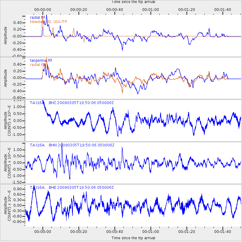
I16A Newdale, ID, USA - Earthquake Result Viewer
*The percent match for this event was below the threshold and hence no stack was calculated.
| Earthquake location: |
North Of Svalbard |
| Earthquake latitude/longitude: |
80.3/-1.8 |
| Earthquake time(UTC): |
2009/03/05 (064) 19:41:40 GMT |
| Earthquake Depth: |
10 km |
| Earthquake Magnitude: |
5.5 MB, 5.0 MS, 5.4 MW |
| Earthquake Catalog/Contributor: |
WHDF/NEIC |
|
| Network: |
TA USArray Transportable Network (new EarthScope stations) |
| Station: |
I16A Newdale, ID, USA |
| Lat/Lon: |
43.88 N/111.49 W |
| Elevation: |
1744 m |
|
| Distance: |
50.3 deg |
| Az: |
297.666 deg |
| Baz: |
12.008 deg |
| Ray Param: |
$rayparam |
*The percent match for this event was below the threshold and hence was not used in the summary stack. |
|
| Radial Match: |
60.315002 % |
| Radial Bump: |
400 |
| Transverse Match: |
59.00536 % |
| Transverse Bump: |
400 |
| SOD ConfigId: |
2658 |
| Insert Time: |
2010-03-06 09:04:01.251 +0000 |
| GWidth: |
2.5 |
| Max Bumps: |
400 |
| Tol: |
0.001 |
|
Signal To Noise
| Channel | StoN | STA | LTA |
| TA:I16A: :BHN:20090305T19:50:06.050006Z | 1.511536 | 4.3419234E-7 | 2.872524E-7 |
| TA:I16A: :BHE:20090305T19:50:06.050006Z | 0.8815617 | 4.3118607E-7 | 4.891162E-7 |
| TA:I16A: :BHZ:20090305T19:50:06.050006Z | 0.9033941 | 3.4561376E-7 | 3.825725E-7 |
| Arrivals |
| Ps | |
| PpPs | |
| PsPs/PpSs | |


