You are here: Home > Network List > UW - Pacific Northwest Regional Seismic Network Stations List
> Station WOLL Wollman Farm, Schrag, WA, USA > Earthquake Result Viewer
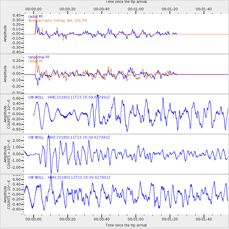
WOLL Wollman Farm, Schrag, WA, USA - Earthquake Result Viewer
*The percent match for this event was below the threshold and hence no stack was calculated.
| Earthquake location: |
South Of Mariana Islands |
| Earthquake latitude/longitude: |
13.8/146.5 |
| Earthquake time(UTC): |
2018/02/11 (042) 23:14:18 GMT |
| Earthquake Depth: |
42 km |
| Earthquake Magnitude: |
6.2 Mi |
| Earthquake Catalog/Contributor: |
NEIC PDE/pt |
|
| Network: |
UW Pacific Northwest Regional Seismic Network |
| Station: |
WOLL Wollman Farm, Schrag, WA, USA |
| Lat/Lon: |
47.06 N/118.92 W |
| Elevation: |
385 m |
|
| Distance: |
83.1 deg |
| Az: |
43.359 deg |
| Baz: |
282.733 deg |
| Ray Param: |
$rayparam |
*The percent match for this event was below the threshold and hence was not used in the summary stack. |
|
| Radial Match: |
67.84941 % |
| Radial Bump: |
342 |
| Transverse Match: |
52.838978 % |
| Transverse Bump: |
362 |
| SOD ConfigId: |
13570011 |
| Insert Time: |
2019-04-29 19:34:18.129 +0000 |
| GWidth: |
2.5 |
| Max Bumps: |
400 |
| Tol: |
0.001 |
|
Signal To Noise
| Channel | StoN | STA | LTA |
| UW:WOLL: :HHZ:20180211T23:26:09.627991Z | 1.9734691 | 4.3478573E-7 | 2.2031543E-7 |
| UW:WOLL: :HHN:20180211T23:26:09.627991Z | 1.5001562 | 3.284021E-7 | 2.1891196E-7 |
| UW:WOLL: :HHE:20180211T23:26:09.627991Z | 0.64041287 | 1.5147275E-7 | 2.3652359E-7 |
| Arrivals |
| Ps | |
| PpPs | |
| PsPs/PpSs | |


