You are here: Home > Network List > UW - Pacific Northwest Regional Seismic Network Stations List
> Station UMAT Pilot Rock, OR, USA > Earthquake Result Viewer
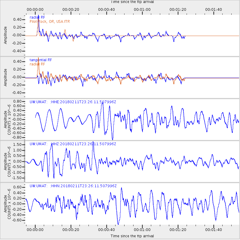
UMAT Pilot Rock, OR, USA - Earthquake Result Viewer
*The percent match for this event was below the threshold and hence no stack was calculated.
| Earthquake location: |
South Of Mariana Islands |
| Earthquake latitude/longitude: |
13.8/146.5 |
| Earthquake time(UTC): |
2018/02/11 (042) 23:14:18 GMT |
| Earthquake Depth: |
42 km |
| Earthquake Magnitude: |
6.2 Mi |
| Earthquake Catalog/Contributor: |
NEIC PDE/pt |
|
| Network: |
UW Pacific Northwest Regional Seismic Network |
| Station: |
UMAT Pilot Rock, OR, USA |
| Lat/Lon: |
45.29 N/118.96 W |
| Elevation: |
1318 m |
|
| Distance: |
83.4 deg |
| Az: |
45.1 deg |
| Baz: |
282.91 deg |
| Ray Param: |
$rayparam |
*The percent match for this event was below the threshold and hence was not used in the summary stack. |
|
| Radial Match: |
70.53678 % |
| Radial Bump: |
400 |
| Transverse Match: |
71.750694 % |
| Transverse Bump: |
400 |
| SOD ConfigId: |
13570011 |
| Insert Time: |
2019-04-29 19:34:18.260 +0000 |
| GWidth: |
2.5 |
| Max Bumps: |
400 |
| Tol: |
0.001 |
|
Signal To Noise
| Channel | StoN | STA | LTA |
| UW:UMAT: :HHZ:20180211T23:26:11.507996Z | 1.5517582 | 3.1509745E-7 | 2.0305836E-7 |
| UW:UMAT: :HHN:20180211T23:26:11.507996Z | 1.3465121 | 1.156109E-7 | 8.585954E-8 |
| UW:UMAT: :HHE:20180211T23:26:11.507996Z | 0.908791 | 2.5767878E-7 | 2.835402E-7 |
| Arrivals |
| Ps | |
| PpPs | |
| PsPs/PpSs | |


