You are here: Home > Network List > UW - Pacific Northwest Regional Seismic Network Stations List
> Station YACT Amboy, WA, USA > Earthquake Result Viewer
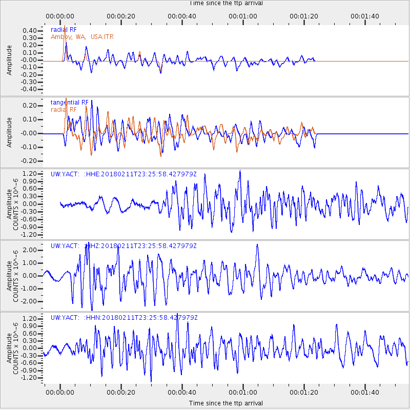
YACT Amboy, WA, USA - Earthquake Result Viewer
*The percent match for this event was below the threshold and hence no stack was calculated.
| Earthquake location: |
South Of Mariana Islands |
| Earthquake latitude/longitude: |
13.8/146.5 |
| Earthquake time(UTC): |
2018/02/11 (042) 23:14:18 GMT |
| Earthquake Depth: |
42 km |
| Earthquake Magnitude: |
6.2 Mi |
| Earthquake Catalog/Contributor: |
NEIC PDE/pt |
|
| Network: |
UW Pacific Northwest Regional Seismic Network |
| Station: |
YACT Amboy, WA, USA |
| Lat/Lon: |
45.93 N/122.42 W |
| Elevation: |
211 m |
|
| Distance: |
80.9 deg |
| Az: |
44.961 deg |
| Baz: |
280.426 deg |
| Ray Param: |
$rayparam |
*The percent match for this event was below the threshold and hence was not used in the summary stack. |
|
| Radial Match: |
77.90618 % |
| Radial Bump: |
400 |
| Transverse Match: |
77.60747 % |
| Transverse Bump: |
400 |
| SOD ConfigId: |
13570011 |
| Insert Time: |
2019-04-29 19:34:18.842 +0000 |
| GWidth: |
2.5 |
| Max Bumps: |
400 |
| Tol: |
0.001 |
|
Signal To Noise
| Channel | StoN | STA | LTA |
| UW:YACT: :HHZ:20180211T23:25:58.427979Z | 4.600361 | 6.2660104E-7 | 1.3620692E-7 |
| UW:YACT: :HHN:20180211T23:25:58.427979Z | 0.7942204 | 1.3731587E-7 | 1.728939E-7 |
| UW:YACT: :HHE:20180211T23:25:58.427979Z | 0.937848 | 1.4729059E-7 | 1.5705166E-7 |
| Arrivals |
| Ps | |
| PpPs | |
| PsPs/PpSs | |


