You are here: Home > Network List > TA - USArray Transportable Network (new EarthScope stations) Stations List
> Station I16A Newdale, ID, USA > Earthquake Result Viewer
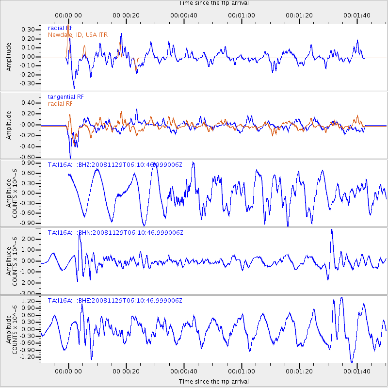
I16A Newdale, ID, USA - Earthquake Result Viewer
*The percent match for this event was below the threshold and hence no stack was calculated.
| Earthquake location: |
Fiji Islands Region |
| Earthquake latitude/longitude: |
-18.7/-177.7 |
| Earthquake time(UTC): |
2008/11/29 (334) 05:59:16 GMT |
| Earthquake Depth: |
386 km |
| Earthquake Magnitude: |
5.7 MB, 6.0 MW, 5.9 MW |
| Earthquake Catalog/Contributor: |
WHDF/NEIC |
|
| Network: |
TA USArray Transportable Network (new EarthScope stations) |
| Station: |
I16A Newdale, ID, USA |
| Lat/Lon: |
43.88 N/111.49 W |
| Elevation: |
1744 m |
|
| Distance: |
86.8 deg |
| Az: |
41.519 deg |
| Baz: |
240.321 deg |
| Ray Param: |
$rayparam |
*The percent match for this event was below the threshold and hence was not used in the summary stack. |
|
| Radial Match: |
60.054756 % |
| Radial Bump: |
343 |
| Transverse Match: |
79.332726 % |
| Transverse Bump: |
370 |
| SOD ConfigId: |
2658 |
| Insert Time: |
2010-03-06 09:04:04.083 +0000 |
| GWidth: |
2.5 |
| Max Bumps: |
400 |
| Tol: |
0.001 |
|
Signal To Noise
| Channel | StoN | STA | LTA |
| TA:I16A: :BHN:20081129T06:10:46.999006Z | 2.735195 | 1.0199016E-6 | 3.7288078E-7 |
| TA:I16A: :BHE:20081129T06:10:46.999006Z | 1.508142 | 5.0083025E-7 | 3.3208428E-7 |
| TA:I16A: :BHZ:20081129T06:10:46.999006Z | 1.388423 | 5.8067496E-7 | 4.182263E-7 |
| Arrivals |
| Ps | |
| PpPs | |
| PsPs/PpSs | |


