You are here: Home > Network List > TA - USArray Transportable Network (new EarthScope stations) Stations List
> Station C16K Lisburne Hills, AK, USA > Earthquake Result Viewer
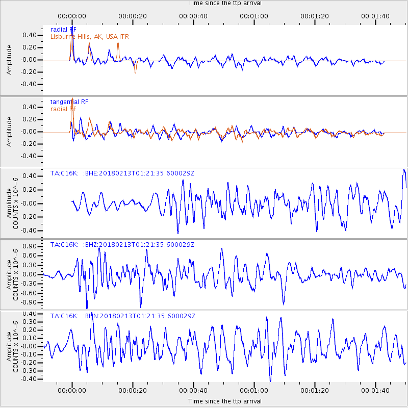
C16K Lisburne Hills, AK, USA - Earthquake Result Viewer
*The percent match for this event was below the threshold and hence no stack was calculated.
| Earthquake location: |
South Of Mariana Islands |
| Earthquake latitude/longitude: |
13.9/146.4 |
| Earthquake time(UTC): |
2018/02/13 (044) 01:11:43 GMT |
| Earthquake Depth: |
12 km |
| Earthquake Magnitude: |
5.4 mb |
| Earthquake Catalog/Contributor: |
NEIC PDE/us |
|
| Network: |
TA USArray Transportable Network (new EarthScope stations) |
| Station: |
C16K Lisburne Hills, AK, USA |
| Lat/Lon: |
68.27 N/165.34 W |
| Elevation: |
102 m |
|
| Distance: |
62.5 deg |
| Az: |
18.248 deg |
| Baz: |
234.774 deg |
| Ray Param: |
$rayparam |
*The percent match for this event was below the threshold and hence was not used in the summary stack. |
|
| Radial Match: |
79.36094 % |
| Radial Bump: |
400 |
| Transverse Match: |
69.41289 % |
| Transverse Bump: |
400 |
| SOD ConfigId: |
13570011 |
| Insert Time: |
2019-04-29 19:38:54.556 +0000 |
| GWidth: |
2.5 |
| Max Bumps: |
400 |
| Tol: |
0.001 |
|
Signal To Noise
| Channel | StoN | STA | LTA |
| TA:C16K: :BHZ:20180213T01:21:35.600029Z | 2.5705965 | 3.3490025E-7 | 1.3028114E-7 |
| TA:C16K: :BHN:20180213T01:21:35.600029Z | 1.5352265 | 1.4275459E-7 | 9.298601E-8 |
| TA:C16K: :BHE:20180213T01:21:35.600029Z | 2.045705 | 1.4529282E-7 | 7.102335E-8 |
| Arrivals |
| Ps | |
| PpPs | |
| PsPs/PpSs | |


