You are here: Home > Network List > TA - USArray Transportable Network (new EarthScope stations) Stations List
> Station I16A Newdale, ID, USA > Earthquake Result Viewer
I16A Newdale, ID, USA - Earthquake Result Viewer
*The percent match for this event was below the threshold and hence no stack was calculated.
| Earthquake location: |
Mariana Islands |
| Earthquake latitude/longitude: |
18.3/145.7 |
| Earthquake time(UTC): |
2009/03/31 (090) 15:29:31 GMT |
| Earthquake Depth: |
188 km |
| Earthquake Magnitude: |
5.5 MW, 5.4 MB, 5.4 MW |
| Earthquake Catalog/Contributor: |
WHDF/NEIC |
|
| Network: |
TA USArray Transportable Network (new EarthScope stations) |
| Station: |
I16A Newdale, ID, USA |
| Lat/Lon: |
43.88 N/111.49 W |
| Elevation: |
1744 m |
|
| Distance: |
86.4 deg |
| Az: |
44.962 deg |
| Baz: |
291.835 deg |
| Ray Param: |
$rayparam |
*The percent match for this event was below the threshold and hence was not used in the summary stack. |
|
| Radial Match: |
46.195354 % |
| Radial Bump: |
400 |
| Transverse Match: |
52.832336 % |
| Transverse Bump: |
400 |
| SOD ConfigId: |
2658 |
| Insert Time: |
2010-03-06 09:04:45.843 +0000 |
| GWidth: |
2.5 |
| Max Bumps: |
400 |
| Tol: |
0.001 |
|
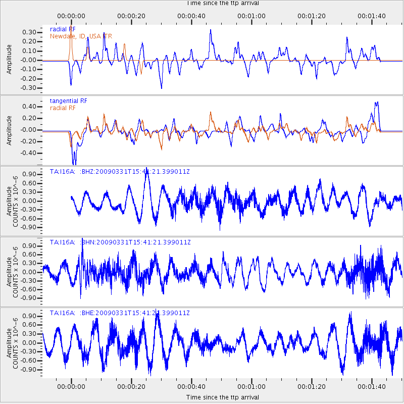
Signal To Noise
| Channel | StoN | STA | LTA |
| TA:I16A: :BHN:20090331T15:41:21.399011Z | 2.8556352 | 3.7597536E-7 | 1.3166084E-7 |
| TA:I16A: :BHE:20090331T15:41:21.399011Z | 0.92810977 | 3.6449688E-7 | 3.9273039E-7 |
| TA:I16A: :BHZ:20090331T15:41:21.399011Z | 1.1382495 | 3.2848214E-7 | 2.8858537E-7 |
| Arrivals |
| Ps | |
| PpPs | |
| PsPs/PpSs | |


