You are here: Home > Network List > TA - USArray Transportable Network (new EarthScope stations) Stations List
> Station J20K Nowitna River, AK, USA > Earthquake Result Viewer
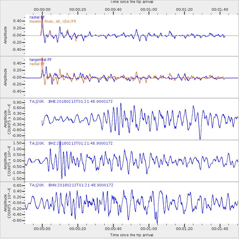
J20K Nowitna River, AK, USA - Earthquake Result Viewer
*The percent match for this event was below the threshold and hence no stack was calculated.
| Earthquake location: |
South Of Mariana Islands |
| Earthquake latitude/longitude: |
13.9/146.4 |
| Earthquake time(UTC): |
2018/02/13 (044) 01:11:43 GMT |
| Earthquake Depth: |
12 km |
| Earthquake Magnitude: |
5.4 mb |
| Earthquake Catalog/Contributor: |
NEIC PDE/us |
|
| Network: |
TA USArray Transportable Network (new EarthScope stations) |
| Station: |
J20K Nowitna River, AK, USA |
| Lat/Lon: |
64.18 N/154.15 W |
| Elevation: |
314 m |
|
| Distance: |
64.5 deg |
| Az: |
24.695 deg |
| Baz: |
247.899 deg |
| Ray Param: |
$rayparam |
*The percent match for this event was below the threshold and hence was not used in the summary stack. |
|
| Radial Match: |
75.21139 % |
| Radial Bump: |
302 |
| Transverse Match: |
68.95217 % |
| Transverse Bump: |
389 |
| SOD ConfigId: |
13570011 |
| Insert Time: |
2019-04-29 19:39:15.397 +0000 |
| GWidth: |
2.5 |
| Max Bumps: |
400 |
| Tol: |
0.001 |
|
Signal To Noise
| Channel | StoN | STA | LTA |
| TA:J20K: :BHZ:20180213T01:21:48.900017Z | 2.4915874 | 4.1484935E-7 | 1.6650003E-7 |
| TA:J20K: :BHN:20180213T01:21:48.900017Z | 0.98285973 | 1.17695485E-7 | 1.19748E-7 |
| TA:J20K: :BHE:20180213T01:21:48.900017Z | 1.8216591 | 2.3708532E-7 | 1.3014802E-7 |
| Arrivals |
| Ps | |
| PpPs | |
| PsPs/PpSs | |


