You are here: Home > Network List > TA - USArray Transportable Network (new EarthScope stations) Stations List
> Station I16A Newdale, ID, USA > Earthquake Result Viewer
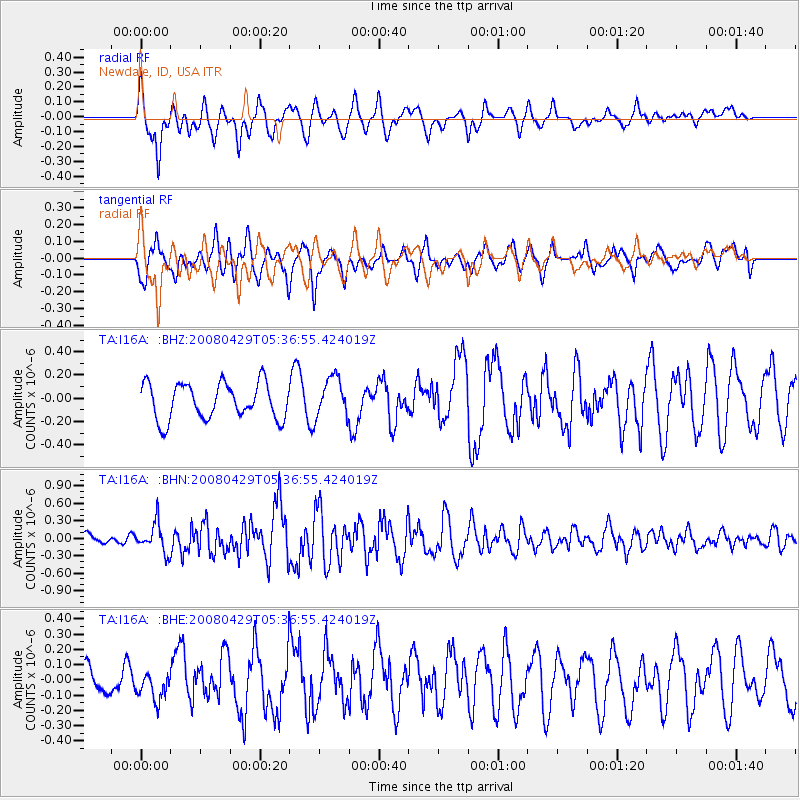
I16A Newdale, ID, USA - Earthquake Result Viewer
*The percent match for this event was below the threshold and hence no stack was calculated.
| Earthquake location: |
Hokkaido, Japan Region |
| Earthquake latitude/longitude: |
41.5/142.0 |
| Earthquake time(UTC): |
2008/04/29 (120) 05:26:04 GMT |
| Earthquake Depth: |
47 km |
| Earthquake Magnitude: |
5.5 MB, 5.2 MS, 5.8 MW, 5.8 MW |
| Earthquake Catalog/Contributor: |
WHDF/NEIC |
|
| Network: |
TA USArray Transportable Network (new EarthScope stations) |
| Station: |
I16A Newdale, ID, USA |
| Lat/Lon: |
43.88 N/111.49 W |
| Elevation: |
1744 m |
|
| Distance: |
72.5 deg |
| Az: |
46.655 deg |
| Baz: |
310.893 deg |
| Ray Param: |
$rayparam |
*The percent match for this event was below the threshold and hence was not used in the summary stack. |
|
| Radial Match: |
66.657745 % |
| Radial Bump: |
400 |
| Transverse Match: |
69.777374 % |
| Transverse Bump: |
400 |
| SOD ConfigId: |
2504 |
| Insert Time: |
2010-03-06 09:04:54.983 +0000 |
| GWidth: |
2.5 |
| Max Bumps: |
400 |
| Tol: |
0.001 |
|
Signal To Noise
| Channel | StoN | STA | LTA |
| TA:I16A: :BHN:20080429T05:36:55.424019Z | 2.2343152 | 2.4880464E-7 | 1.11356115E-7 |
| TA:I16A: :BHE:20080429T05:36:55.424019Z | 1.0778838 | 8.801935E-8 | 8.16594E-8 |
| TA:I16A: :BHZ:20080429T05:36:55.424019Z | 1.1195184 | 1.7230863E-7 | 1.5391318E-7 |
| Arrivals |
| Ps | |
| PpPs | |
| PsPs/PpSs | |


