You are here: Home > Network List > AK - Alaska Regional Network Stations List
> Station CUT Chulitna, AK, USA > Earthquake Result Viewer
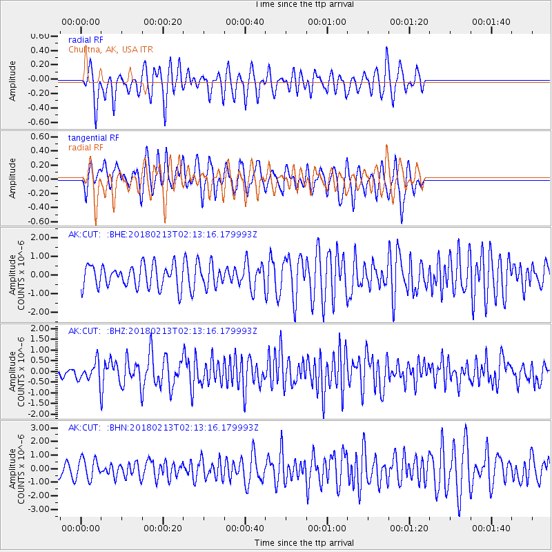
CUT Chulitna, AK, USA - Earthquake Result Viewer
*The percent match for this event was below the threshold and hence no stack was calculated.
| Earthquake location: |
South Of Mariana Islands |
| Earthquake latitude/longitude: |
13.8/146.7 |
| Earthquake time(UTC): |
2018/02/13 (044) 02:03:03 GMT |
| Earthquake Depth: |
10 km |
| Earthquake Magnitude: |
5.7 mww |
| Earthquake Catalog/Contributor: |
NEIC PDE/pt |
|
| Network: |
AK Alaska Regional Network |
| Station: |
CUT Chulitna, AK, USA |
| Lat/Lon: |
62.41 N/150.26 W |
| Elevation: |
574 m |
|
| Distance: |
65.5 deg |
| Az: |
27.154 deg |
| Baz: |
252.173 deg |
| Ray Param: |
$rayparam |
*The percent match for this event was below the threshold and hence was not used in the summary stack. |
|
| Radial Match: |
62.893673 % |
| Radial Bump: |
365 |
| Transverse Match: |
65.685776 % |
| Transverse Bump: |
400 |
| SOD ConfigId: |
13570011 |
| Insert Time: |
2019-04-29 19:41:13.015 +0000 |
| GWidth: |
2.5 |
| Max Bumps: |
400 |
| Tol: |
0.001 |
|
Signal To Noise
| Channel | StoN | STA | LTA |
| AK:CUT: :BHZ:20180213T02:13:16.179993Z | 1.8049119 | 5.2000945E-7 | 2.8810794E-7 |
| AK:CUT: :BHN:20180213T02:13:16.179993Z | 1.165129 | 7.3851044E-7 | 6.338444E-7 |
| AK:CUT: :BHE:20180213T02:13:16.179993Z | 1.1690967 | 6.484837E-7 | 5.5468786E-7 |
| Arrivals |
| Ps | |
| PpPs | |
| PsPs/PpSs | |


