You are here: Home > Network List > AK - Alaska Regional Network Stations List
> Station GAMB Gambell Broadband > Earthquake Result Viewer
GAMB Gambell Broadband - Earthquake Result Viewer
*The percent match for this event was below the threshold and hence no stack was calculated.
| Earthquake location: |
South Of Mariana Islands |
| Earthquake latitude/longitude: |
13.8/146.7 |
| Earthquake time(UTC): |
2018/02/13 (044) 02:03:03 GMT |
| Earthquake Depth: |
10 km |
| Earthquake Magnitude: |
5.7 mww |
| Earthquake Catalog/Contributor: |
NEIC PDE/pt |
|
| Network: |
AK Alaska Regional Network |
| Station: |
GAMB Gambell Broadband |
| Lat/Lon: |
63.78 N/171.70 W |
| Elevation: |
10 m |
|
| Distance: |
57.6 deg |
| Az: |
20.458 deg |
| Baz: |
229.834 deg |
| Ray Param: |
$rayparam |
*The percent match for this event was below the threshold and hence was not used in the summary stack. |
|
| Radial Match: |
76.19437 % |
| Radial Bump: |
400 |
| Transverse Match: |
61.881416 % |
| Transverse Bump: |
400 |
| SOD ConfigId: |
13570011 |
| Insert Time: |
2019-04-29 19:41:15.796 +0000 |
| GWidth: |
2.5 |
| Max Bumps: |
400 |
| Tol: |
0.001 |
|
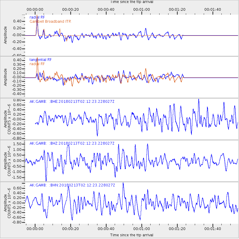
Signal To Noise
| Channel | StoN | STA | LTA |
| AK:GAMB: :BHZ:20180213T02:12:23.228027Z | 1.2560533 | 2.44635E-7 | 1.9476482E-7 |
| AK:GAMB: :BHN:20180213T02:12:23.228027Z | 1.3693355 | 1.9974635E-7 | 1.4587101E-7 |
| AK:GAMB: :BHE:20180213T02:12:23.228027Z | 0.90944946 | 1.2485003E-7 | 1.372809E-7 |
| Arrivals |
| Ps | |
| PpPs | |
| PsPs/PpSs | |


