You are here: Home > Network List > IU - Global Seismograph Network (GSN - IRIS/USGS) Stations List
> Station RSSD Black Hills, South Dakota, USA > Earthquake Result Viewer
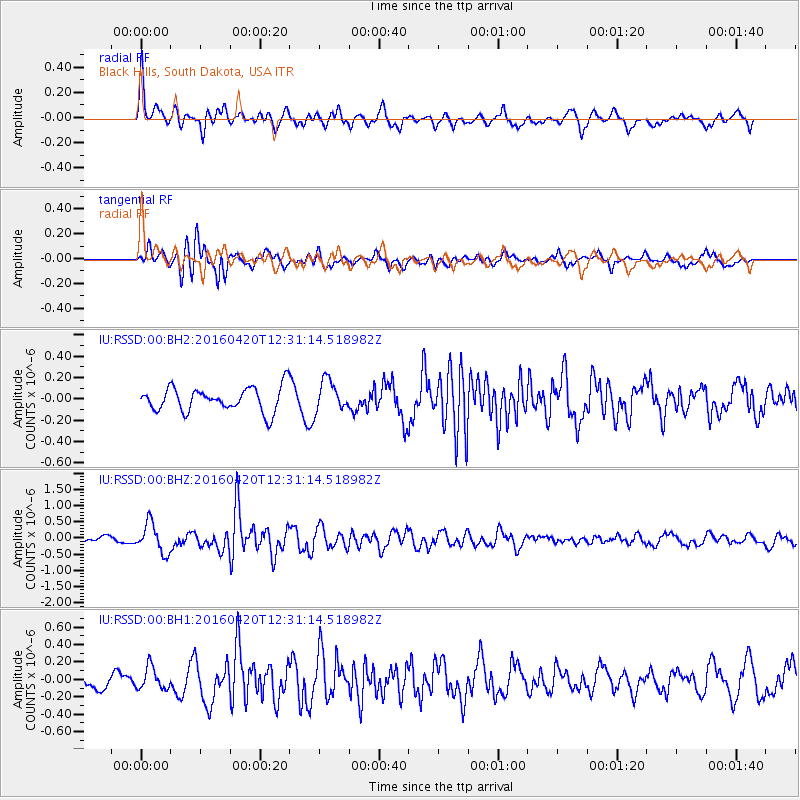
RSSD Black Hills, South Dakota, USA - Earthquake Result Viewer
*The percent match for this event was below the threshold and hence no stack was calculated.
| Earthquake location: |
Near East Coast Of Honshu, Japan |
| Earthquake latitude/longitude: |
37.8/141.6 |
| Earthquake time(UTC): |
2016/04/20 (111) 12:19:45 GMT |
| Earthquake Depth: |
41 km |
| Earthquake Magnitude: |
5.8 MB |
| Earthquake Catalog/Contributor: |
NEIC PDE/NEIC ALERT |
|
| Network: |
IU Global Seismograph Network (GSN - IRIS/USGS) |
| Station: |
RSSD Black Hills, South Dakota, USA |
| Lat/Lon: |
44.12 N/104.04 W |
| Elevation: |
2090 m |
|
| Distance: |
79.2 deg |
| Az: |
41.909 deg |
| Baz: |
312.73 deg |
| Ray Param: |
$rayparam |
*The percent match for this event was below the threshold and hence was not used in the summary stack. |
|
| Radial Match: |
66.98788 % |
| Radial Bump: |
400 |
| Transverse Match: |
71.39988 % |
| Transverse Bump: |
400 |
| SOD ConfigId: |
1475611 |
| Insert Time: |
2016-05-04 12:24:14.050 +0000 |
| GWidth: |
2.5 |
| Max Bumps: |
400 |
| Tol: |
0.001 |
|
Signal To Noise
| Channel | StoN | STA | LTA |
| IU:RSSD:00:BHZ:20160420T12:31:14.518982Z | 2.8478324 | 4.53917E-7 | 1.5939035E-7 |
| IU:RSSD:00:BH1:20160420T12:31:14.518982Z | 1.3334112 | 1.2859307E-7 | 9.6439166E-8 |
| IU:RSSD:00:BH2:20160420T12:31:14.518982Z | 1.2949969 | 1.4656644E-7 | 1.13178984E-7 |
| Arrivals |
| Ps | |
| PpPs | |
| PsPs/PpSs | |


