You are here: Home > Network List > CN - Canadian National Seismograph Network Stations List
> Station INK INUVIK, NT > Earthquake Result Viewer
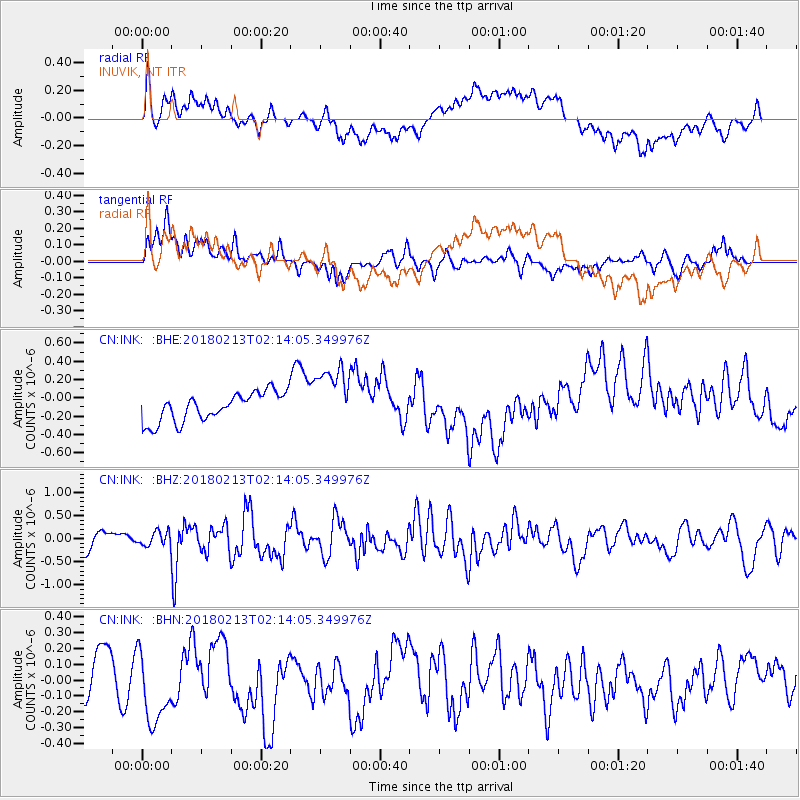
INK INUVIK, NT - Earthquake Result Viewer
*The percent match for this event was below the threshold and hence no stack was calculated.
| Earthquake location: |
South Of Mariana Islands |
| Earthquake latitude/longitude: |
13.8/146.7 |
| Earthquake time(UTC): |
2018/02/13 (044) 02:03:03 GMT |
| Earthquake Depth: |
10 km |
| Earthquake Magnitude: |
5.7 mww |
| Earthquake Catalog/Contributor: |
NEIC PDE/pt |
|
| Network: |
CN Canadian National Seismograph Network |
| Station: |
INK INUVIK, NT |
| Lat/Lon: |
68.31 N/133.53 W |
| Elevation: |
44 m |
|
| Distance: |
73.5 deg |
| Az: |
22.44 deg |
| Baz: |
265.748 deg |
| Ray Param: |
$rayparam |
*The percent match for this event was below the threshold and hence was not used in the summary stack. |
|
| Radial Match: |
52.74933 % |
| Radial Bump: |
400 |
| Transverse Match: |
67.76476 % |
| Transverse Bump: |
400 |
| SOD ConfigId: |
13570011 |
| Insert Time: |
2019-04-29 19:42:51.267 +0000 |
| GWidth: |
2.5 |
| Max Bumps: |
400 |
| Tol: |
0.001 |
|
Signal To Noise
| Channel | StoN | STA | LTA |
| CN:INK: :BHZ:20180213T02:14:05.349976Z | 0.77517676 | 1.5769427E-7 | 2.0343009E-7 |
| CN:INK: :BHN:20180213T02:14:05.349976Z | 1.5474793 | 2.6969482E-7 | 1.7428009E-7 |
| CN:INK: :BHE:20180213T02:14:05.349976Z | 2.2629664 | 3.5022444E-7 | 1.5476344E-7 |
| Arrivals |
| Ps | |
| PpPs | |
| PsPs/PpSs | |


