You are here: Home > Network List > TA - USArray Transportable Network (new EarthScope stations) Stations List
> Station I16A Newdale, ID, USA > Earthquake Result Viewer
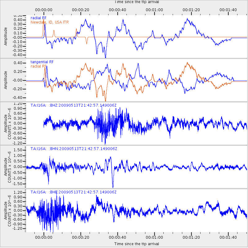
I16A Newdale, ID, USA - Earthquake Result Viewer
*The percent match for this event was below the threshold and hence no stack was calculated.
| Earthquake location: |
Tonga Islands |
| Earthquake latitude/longitude: |
-15.8/-173.5 |
| Earthquake time(UTC): |
2009/05/13 (133) 21:31:17 GMT |
| Earthquake Depth: |
85 km |
| Earthquake Magnitude: |
5.8 MW, 5.3 MB, 5.8 MW |
| Earthquake Catalog/Contributor: |
WHDF/NEIC |
|
| Network: |
TA USArray Transportable Network (new EarthScope stations) |
| Station: |
I16A Newdale, ID, USA |
| Lat/Lon: |
43.88 N/111.49 W |
| Elevation: |
1744 m |
|
| Distance: |
81.9 deg |
| Az: |
40.161 deg |
| Baz: |
239.179 deg |
| Ray Param: |
$rayparam |
*The percent match for this event was below the threshold and hence was not used in the summary stack. |
|
| Radial Match: |
49.32874 % |
| Radial Bump: |
400 |
| Transverse Match: |
45.045605 % |
| Transverse Bump: |
400 |
| SOD ConfigId: |
2760 |
| Insert Time: |
2010-03-06 09:05:41.905 +0000 |
| GWidth: |
2.5 |
| Max Bumps: |
400 |
| Tol: |
0.001 |
|
Signal To Noise
| Channel | StoN | STA | LTA |
| TA:I16A: :BHN:20090513T21:42:57.149006Z | 5.4562016 | 4.600176E-7 | 8.431096E-8 |
| TA:I16A: :BHE:20090513T21:42:57.149006Z | 3.5154395 | 6.3357294E-7 | 1.8022581E-7 |
| TA:I16A: :BHZ:20090513T21:42:57.149006Z | 3.0858235 | 5.044439E-7 | 1.634714E-7 |
| Arrivals |
| Ps | |
| PpPs | |
| PsPs/PpSs | |


