You are here: Home > Network List > TA - USArray Transportable Network (new EarthScope stations) Stations List
> Station G22K Bettles, AK, USA > Earthquake Result Viewer
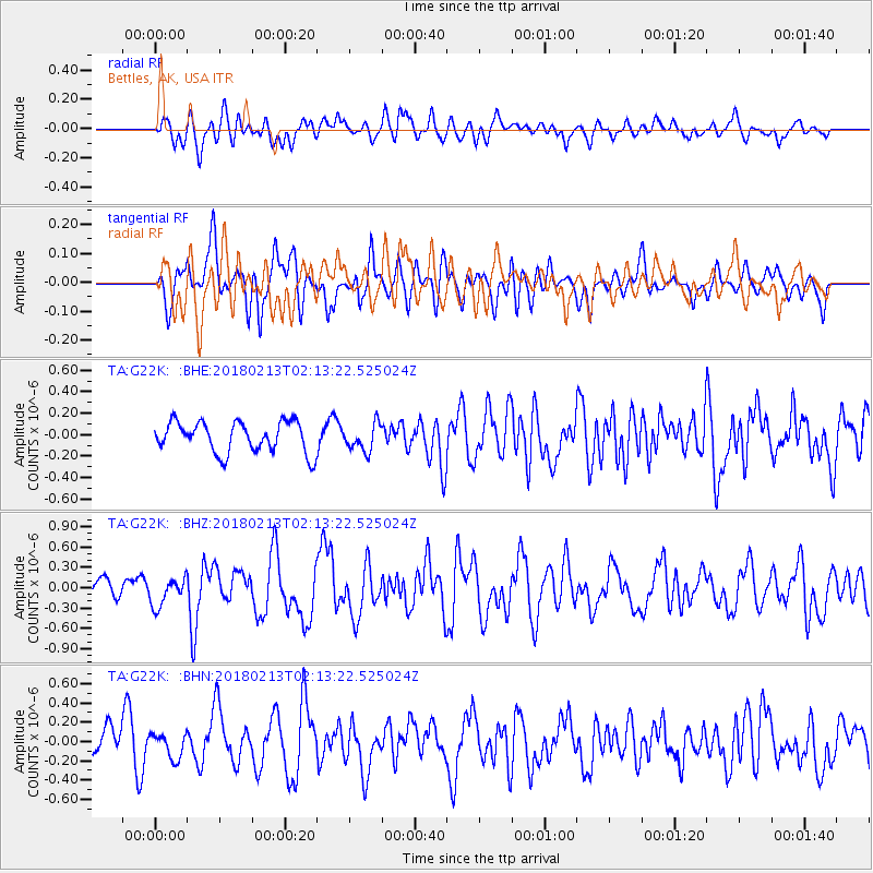
G22K Bettles, AK, USA - Earthquake Result Viewer
*The percent match for this event was below the threshold and hence no stack was calculated.
| Earthquake location: |
South Of Mariana Islands |
| Earthquake latitude/longitude: |
13.8/146.7 |
| Earthquake time(UTC): |
2018/02/13 (044) 02:03:03 GMT |
| Earthquake Depth: |
10 km |
| Earthquake Magnitude: |
5.7 mww |
| Earthquake Catalog/Contributor: |
NEIC PDE/pt |
|
| Network: |
TA USArray Transportable Network (new EarthScope stations) |
| Station: |
G22K Bettles, AK, USA |
| Lat/Lon: |
66.92 N/151.51 W |
| Elevation: |
205 m |
|
| Distance: |
66.5 deg |
| Az: |
22.275 deg |
| Baz: |
249.06 deg |
| Ray Param: |
$rayparam |
*The percent match for this event was below the threshold and hence was not used in the summary stack. |
|
| Radial Match: |
57.8512 % |
| Radial Bump: |
400 |
| Transverse Match: |
53.58913 % |
| Transverse Bump: |
400 |
| SOD ConfigId: |
13570011 |
| Insert Time: |
2019-04-29 19:45:06.122 +0000 |
| GWidth: |
2.5 |
| Max Bumps: |
400 |
| Tol: |
0.001 |
|
Signal To Noise
| Channel | StoN | STA | LTA |
| TA:G22K: :BHZ:20180213T02:13:22.525024Z | 1.5598468 | 2.0360902E-7 | 1.3053142E-7 |
| TA:G22K: :BHN:20180213T02:13:22.525024Z | 1.0574474 | 1.2682037E-7 | 1.1993065E-7 |
| TA:G22K: :BHE:20180213T02:13:22.525024Z | 0.9512136 | 1.2459714E-7 | 1.3098754E-7 |
| Arrivals |
| Ps | |
| PpPs | |
| PsPs/PpSs | |


