You are here: Home > Network List > TA - USArray Transportable Network (new EarthScope stations) Stations List
> Station I16A Newdale, ID, USA > Earthquake Result Viewer
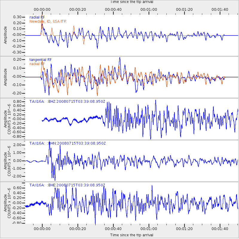
I16A Newdale, ID, USA - Earthquake Result Viewer
*The percent match for this event was below the threshold and hence no stack was calculated.
| Earthquake location: |
Dodecanese Islands, Greece |
| Earthquake latitude/longitude: |
35.8/27.9 |
| Earthquake time(UTC): |
2008/07/15 (197) 03:26:34 GMT |
| Earthquake Depth: |
52 km |
| Earthquake Magnitude: |
6.5 MB, 6.4 MW, 6.4 MW |
| Earthquake Catalog/Contributor: |
WHDF/NEIC |
|
| Network: |
TA USArray Transportable Network (new EarthScope stations) |
| Station: |
I16A Newdale, ID, USA |
| Lat/Lon: |
43.88 N/111.49 W |
| Elevation: |
1744 m |
|
| Distance: |
92.5 deg |
| Az: |
331.863 deg |
| Baz: |
32.013 deg |
| Ray Param: |
$rayparam |
*The percent match for this event was below the threshold and hence was not used in the summary stack. |
|
| Radial Match: |
77.42966 % |
| Radial Bump: |
400 |
| Transverse Match: |
80.6366 % |
| Transverse Bump: |
400 |
| SOD ConfigId: |
2504 |
| Insert Time: |
2010-03-06 09:05:49.780 +0000 |
| GWidth: |
2.5 |
| Max Bumps: |
400 |
| Tol: |
0.001 |
|
Signal To Noise
| Channel | StoN | STA | LTA |
| TA:I16A: :BHN:20080715T03:39:08.950Z | 17.043787 | 7.7789554E-7 | 4.5641002E-8 |
| TA:I16A: :BHE:20080715T03:39:08.950Z | 1.2780448 | 1.2896297E-7 | 1.00906455E-7 |
| TA:I16A: :BHZ:20080715T03:39:08.950Z | 1.8663899 | 1.3595213E-7 | 7.28423E-8 |
| Arrivals |
| Ps | |
| PpPs | |
| PsPs/PpSs | |


