You are here: Home > Network List > US - United States National Seismic Network Stations List
> Station DGMT Dagmar, Montana, USA > Earthquake Result Viewer
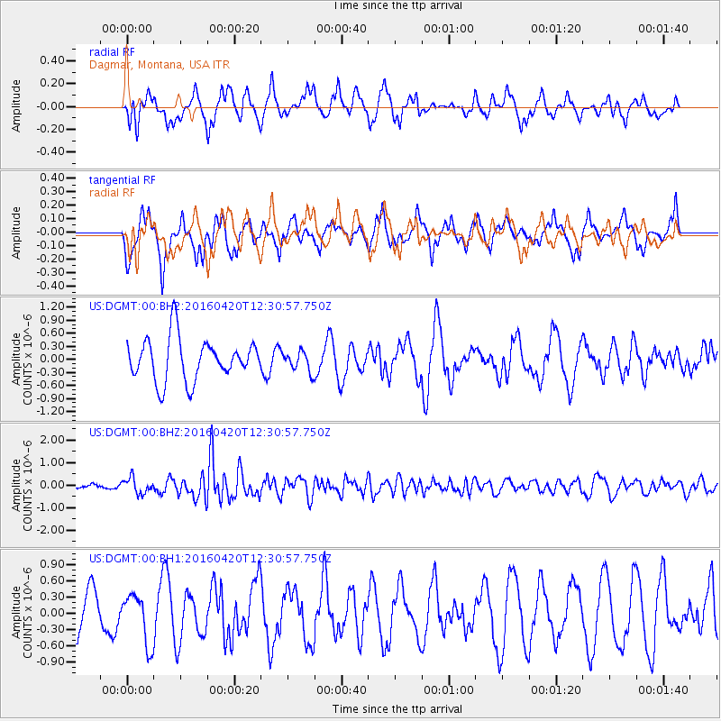
DGMT Dagmar, Montana, USA - Earthquake Result Viewer
*The percent match for this event was below the threshold and hence no stack was calculated.
| Earthquake location: |
Near East Coast Of Honshu, Japan |
| Earthquake latitude/longitude: |
37.8/141.6 |
| Earthquake time(UTC): |
2016/04/20 (111) 12:19:45 GMT |
| Earthquake Depth: |
41 km |
| Earthquake Magnitude: |
5.8 MB |
| Earthquake Catalog/Contributor: |
NEIC PDE/NEIC ALERT |
|
| Network: |
US United States National Seismic Network |
| Station: |
DGMT Dagmar, Montana, USA |
| Lat/Lon: |
48.47 N/104.20 W |
| Elevation: |
0.0 m |
|
| Distance: |
76.1 deg |
| Az: |
38.693 deg |
| Baz: |
311.927 deg |
| Ray Param: |
$rayparam |
*The percent match for this event was below the threshold and hence was not used in the summary stack. |
|
| Radial Match: |
56.956543 % |
| Radial Bump: |
339 |
| Transverse Match: |
65.01967 % |
| Transverse Bump: |
400 |
| SOD ConfigId: |
1475611 |
| Insert Time: |
2016-05-04 12:26:22.462 +0000 |
| GWidth: |
2.5 |
| Max Bumps: |
400 |
| Tol: |
0.001 |
|
Signal To Noise
| Channel | StoN | STA | LTA |
| US:DGMT:00:BHZ:20160420T12:30:57.750Z | 2.4740746 | 3.4780427E-7 | 1.4057954E-7 |
| US:DGMT:00:BH1:20160420T12:30:57.750Z | 1.4675517 | 4.6453218E-7 | 3.1653548E-7 |
| US:DGMT:00:BH2:20160420T12:30:57.750Z | 0.4692688 | 2.2668982E-7 | 4.830703E-7 |
| Arrivals |
| Ps | |
| PpPs | |
| PsPs/PpSs | |


