You are here: Home > Network List > CN - Canadian National Seismograph Network Stations List
> Station INK INUVIK, NT > Earthquake Result Viewer
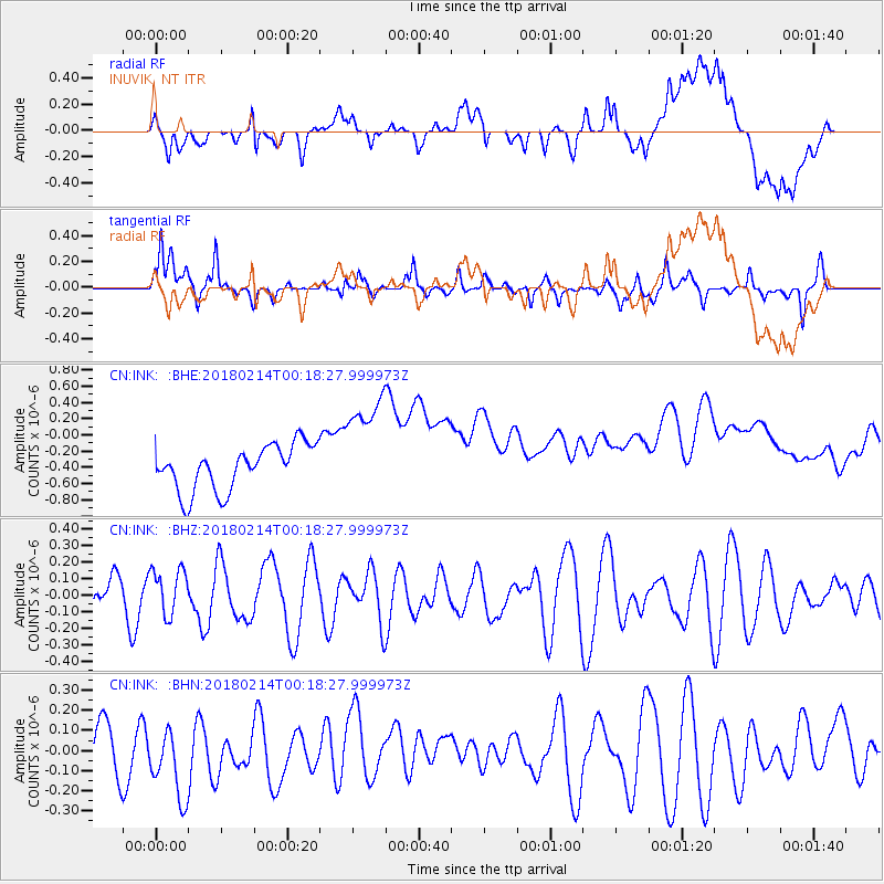
INK INUVIK, NT - Earthquake Result Viewer
*The percent match for this event was below the threshold and hence no stack was calculated.
| Earthquake location: |
Aru Islands Region, Indonesia |
| Earthquake latitude/longitude: |
-6.0/133.8 |
| Earthquake time(UTC): |
2018/02/14 (045) 00:05:30 GMT |
| Earthquake Depth: |
10 km |
| Earthquake Magnitude: |
5.5 mb |
| Earthquake Catalog/Contributor: |
NEIC PDE/us |
|
| Network: |
CN Canadian National Seismograph Network |
| Station: |
INK INUVIK, NT |
| Lat/Lon: |
68.31 N/133.53 W |
| Elevation: |
44 m |
|
| Distance: |
96.5 deg |
| Az: |
21.95 deg |
| Baz: |
270.256 deg |
| Ray Param: |
$rayparam |
*The percent match for this event was below the threshold and hence was not used in the summary stack. |
|
| Radial Match: |
19.087284 % |
| Radial Bump: |
400 |
| Transverse Match: |
58.90026 % |
| Transverse Bump: |
392 |
| SOD ConfigId: |
13570011 |
| Insert Time: |
2019-04-29 19:55:16.024 +0000 |
| GWidth: |
2.5 |
| Max Bumps: |
400 |
| Tol: |
0.001 |
|
Signal To Noise
| Channel | StoN | STA | LTA |
| CN:INK: :BHZ:20180214T00:18:27.999973Z | 0.9263664 | 1.3665617E-7 | 1.4751849E-7 |
| CN:INK: :BHN:20180214T00:18:27.999973Z | 1.0796355 | 1.8754994E-7 | 1.73716E-7 |
| CN:INK: :BHE:20180214T00:18:27.999973Z | 2.4810922 | 6.926666E-7 | 2.7917812E-7 |
| Arrivals |
| Ps | |
| PpPs | |
| PsPs/PpSs | |


