You are here: Home > Network List > US - United States National Seismic Network Stations List
> Station NEW Newport, Washington, USA > Earthquake Result Viewer
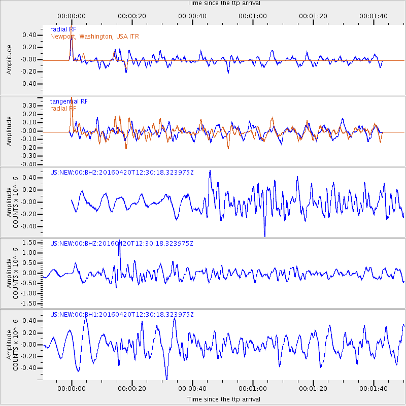
NEW Newport, Washington, USA - Earthquake Result Viewer
*The percent match for this event was below the threshold and hence no stack was calculated.
| Earthquake location: |
Near East Coast Of Honshu, Japan |
| Earthquake latitude/longitude: |
37.8/141.6 |
| Earthquake time(UTC): |
2016/04/20 (111) 12:19:45 GMT |
| Earthquake Depth: |
41 km |
| Earthquake Magnitude: |
5.8 MB |
| Earthquake Catalog/Contributor: |
NEIC PDE/NEIC ALERT |
|
| Network: |
US United States National Seismic Network |
| Station: |
NEW Newport, Washington, USA |
| Lat/Lon: |
48.26 N/117.12 W |
| Elevation: |
760 m |
|
| Distance: |
69.5 deg |
| Az: |
44.401 deg |
| Baz: |
303.968 deg |
| Ray Param: |
$rayparam |
*The percent match for this event was below the threshold and hence was not used in the summary stack. |
|
| Radial Match: |
58.54966 % |
| Radial Bump: |
361 |
| Transverse Match: |
40.880672 % |
| Transverse Bump: |
352 |
| SOD ConfigId: |
1475611 |
| Insert Time: |
2016-05-04 12:27:19.944 +0000 |
| GWidth: |
2.5 |
| Max Bumps: |
400 |
| Tol: |
0.001 |
|
Signal To Noise
| Channel | StoN | STA | LTA |
| US:NEW:00:BHZ:20160420T12:30:18.323975Z | 2.1475625 | 2.767653E-7 | 1.2887415E-7 |
| US:NEW:00:BH1:20160420T12:30:18.323975Z | 2.5013196 | 3.006028E-7 | 1.2017767E-7 |
| US:NEW:00:BH2:20160420T12:30:18.323975Z | 1.3846257 | 1.2010965E-7 | 8.67452E-8 |
| Arrivals |
| Ps | |
| PpPs | |
| PsPs/PpSs | |


