You are here: Home > Network List > TA - USArray Transportable Network (new EarthScope stations) Stations List
> Station SFIN Lafayette, IN, USA > Earthquake Result Viewer
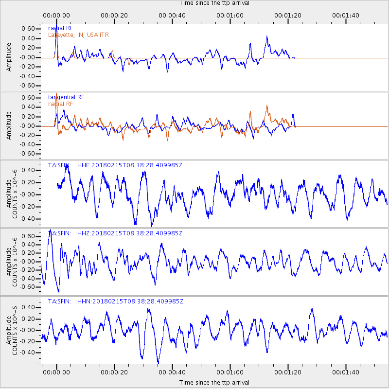
SFIN Lafayette, IN, USA - Earthquake Result Viewer
*The percent match for this event was below the threshold and hence no stack was calculated.
| Earthquake location: |
North Of Ascension Island |
| Earthquake latitude/longitude: |
-0.1/-17.8 |
| Earthquake time(UTC): |
2018/02/15 (046) 08:27:22 GMT |
| Earthquake Depth: |
10 km |
| Earthquake Magnitude: |
5.6 Mww |
| Earthquake Catalog/Contributor: |
NEIC PDE/us |
|
| Network: |
TA USArray Transportable Network (new EarthScope stations) |
| Station: |
SFIN Lafayette, IN, USA |
| Lat/Lon: |
40.38 N/87.10 W |
| Elevation: |
165 m |
|
| Distance: |
74.4 deg |
| Az: |
312.105 deg |
| Baz: |
103.784 deg |
| Ray Param: |
$rayparam |
*The percent match for this event was below the threshold and hence was not used in the summary stack. |
|
| Radial Match: |
65.582054 % |
| Radial Bump: |
400 |
| Transverse Match: |
49.075912 % |
| Transverse Bump: |
400 |
| SOD ConfigId: |
13570011 |
| Insert Time: |
2019-04-29 20:03:04.364 +0000 |
| GWidth: |
2.5 |
| Max Bumps: |
400 |
| Tol: |
0.001 |
|
Signal To Noise
| Channel | StoN | STA | LTA |
| TA:SFIN: :HHZ:20180215T08:38:28.409985Z | 2.4976842 | 3.4032533E-7 | 1.3625633E-7 |
| TA:SFIN: :HHN:20180215T08:38:28.409985Z | 0.54815686 | 1.0987832E-7 | 2.0045051E-7 |
| TA:SFIN: :HHE:20180215T08:38:28.409985Z | 2.074433 | 3.6606156E-7 | 1.7646342E-7 |
| Arrivals |
| Ps | |
| PpPs | |
| PsPs/PpSs | |


