Y12C Blythe, CA, USA - Earthquake Result Viewer
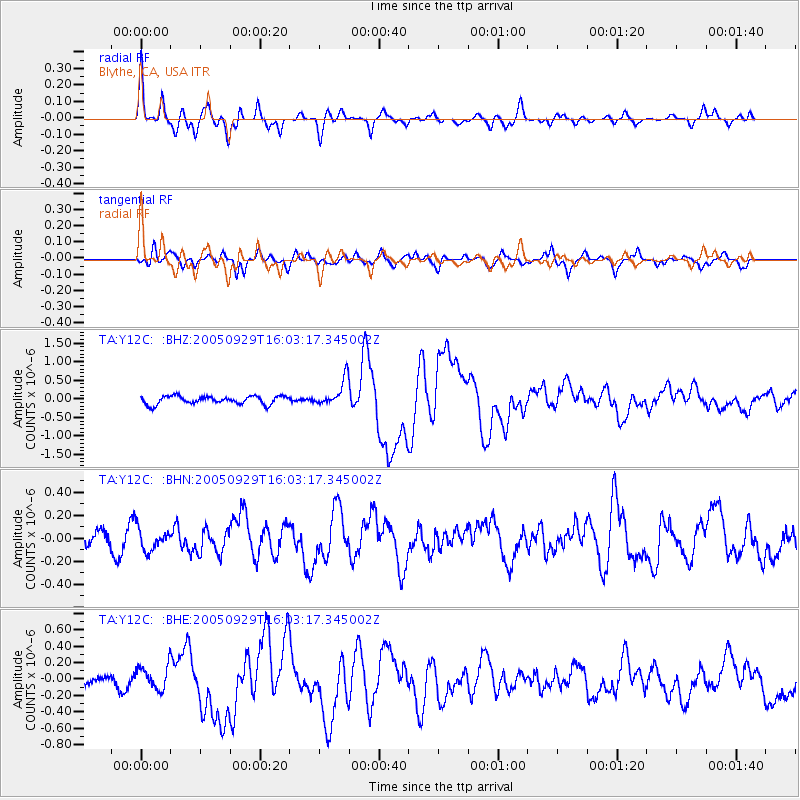
Earthquake location: New Britain Region, P.N.G.
Earthquake latitude/longitude: -5.4/151.8
Earthquake time(UTC): 2005/09/29 (272) 15:50:24 GMT
Earthquake Depth: 25 km
Earthquake Magnitude: 5.9 MB, 6.6 MS, 6.7 MW, 6.5 MW
Earthquake Catalog/Contributor: WHDF/NEIC
Network: TA USArray Transportable Network (new EarthScope stations)
Station: Y12C Blythe, CA, USA
Lat/Lon: 33.75 N/114.52 W
Elevation: 196 m
Distance: 96.0 deg
Az: 56.73 deg
Baz: 267.493 deg
Ray Param: 0.040622026
Estimated Moho Depth: 24.25 km
Estimated Crust Vp/Vs: 1.89
Assumed Crust Vp: 6.155 km/s
Estimated Crust Vs: 3.248 km/s
Estimated Crust Poisson's Ratio: 0.31
Radial Match: 87.90297 %
Radial Bump: 400
Transverse Match: 77.81784 %
Transverse Bump: 400
SOD ConfigId: 2475
Insert Time: 2010-03-06 09:08:11.501 +0000
GWidth: 2.5
Max Bumps: 400
Tol: 0.001

Signal To Noise

ChannelStoNSTALTA
TA:Y12C: :BHN:20050929T16:03:17.345002Z1.93404929.7249874E-85.028304E-8
TA:Y12C: :BHE:20050929T16:03:17.345002Z1.4202391.4350266E-71.010412E-7
TA:Y12C: :BHZ:20050929T16:03:17.345002Z3.30574873.546013E-71.0726808E-7
Arrivals
Ps3.6 SECOND
PpPs11 SECOND
PsPs/PpSs15 SECOND