Y12C Blythe, CA, USA - Earthquake Result Viewer
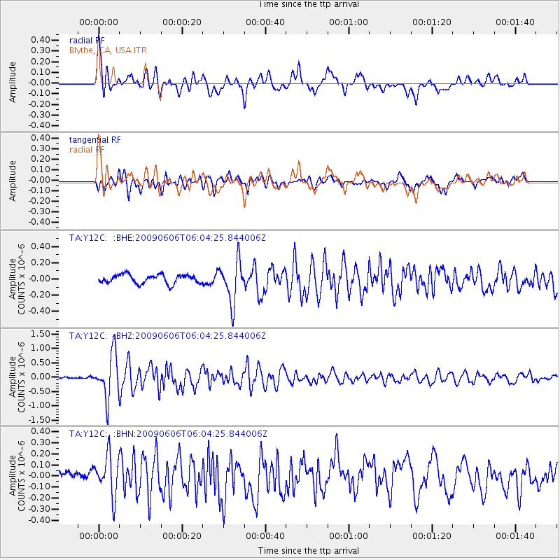
Earthquake location: Near East Coast Of Honshu, Japan
Earthquake latitude/longitude: 35.5/140.9
Earthquake time(UTC): 2009/06/06 (157) 05:52:43 GMT
Earthquake Depth: 34 km
Earthquake Magnitude: 5.8 MB, 5.4 MS, 5.8 MW, 5.7 MW
Earthquake Catalog/Contributor: WHDF/NEIC
Network: TA USArray Transportable Network (new EarthScope stations)
Station: Y12C Blythe, CA, USA
Lat/Lon: 33.75 N/114.52 W
Elevation: 196 m
Distance: 81.5 deg
Az: 54.634 deg
Baz: 306.987 deg
Ray Param: 0.047527805
Estimated Moho Depth: 62.75 km
Estimated Crust Vp/Vs: 2.10
Assumed Crust Vp: 6.155 km/s
Estimated Crust Vs: 2.934 km/s
Estimated Crust Poisson's Ratio: 0.35
Radial Match: 85.987625 %
Radial Bump: 400
Transverse Match: 76.292496 %
Transverse Bump: 400
SOD ConfigId: 2648
Insert Time: 2010-03-06 09:10:31.746 +0000
GWidth: 2.5
Max Bumps: 400
Tol: 0.001

Signal To Noise

ChannelStoNSTALTA
TA:Y12C: :BHZ:20090606T06:04:25.844006Z11.4127747.981093E-76.9931225E-8
TA:Y12C: :BHN:20090606T06:04:25.844006Z5.10614351.9012002E-73.7233587E-8
TA:Y12C: :BHE:20090606T06:04:25.844006Z4.80877452.5956348E-75.3977054E-8
Arrivals
Ps11 SECOND
PpPs31 SECOND
PsPs/PpSs42 SECOND