You are here: Home > Network List > GS - US Geological Survey Networks Stations List
> Station KAN10 Keim Farm > Earthquake Result Viewer
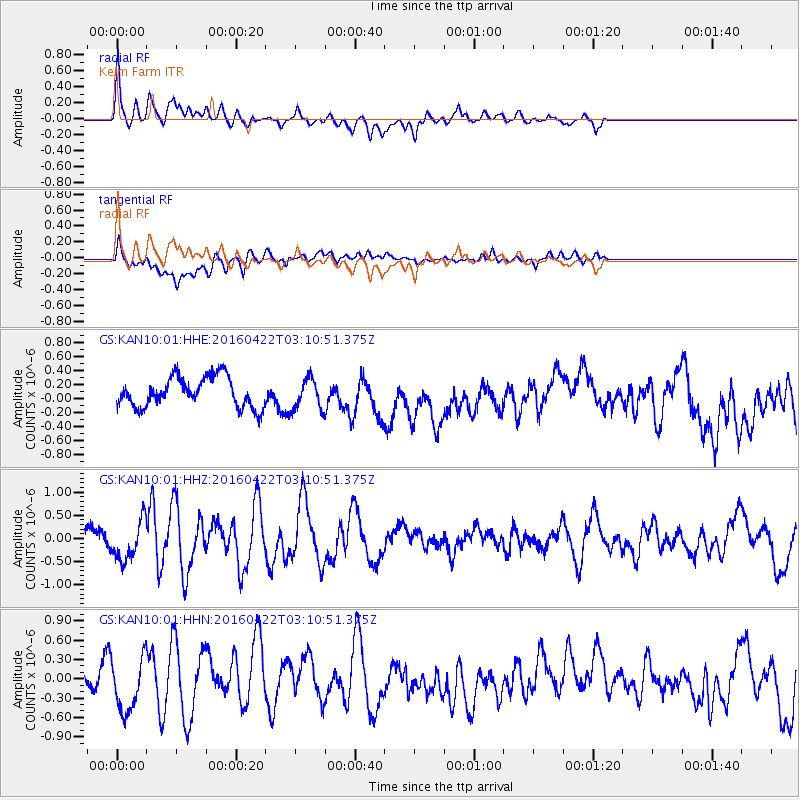
KAN10 Keim Farm - Earthquake Result Viewer
*The percent match for this event was below the threshold and hence no stack was calculated.
| Earthquake location: |
Near Coast Of Ecuador |
| Earthquake latitude/longitude: |
-0.3/-80.5 |
| Earthquake time(UTC): |
2016/04/22 (113) 03:03:42 GMT |
| Earthquake Depth: |
10 km |
| Earthquake Magnitude: |
6.0 MO |
| Earthquake Catalog/Contributor: |
NEIC PDE/NEIC ALERT |
|
| Network: |
GS US Geological Survey Networks |
| Station: |
KAN10 Keim Farm |
| Lat/Lon: |
37.12 N/98.10 W |
| Elevation: |
417 m |
|
| Distance: |
40.7 deg |
| Az: |
338.286 deg |
| Baz: |
152.427 deg |
| Ray Param: |
$rayparam |
*The percent match for this event was below the threshold and hence was not used in the summary stack. |
|
| Radial Match: |
69.38279 % |
| Radial Bump: |
400 |
| Transverse Match: |
53.277924 % |
| Transverse Bump: |
400 |
| SOD ConfigId: |
1475611 |
| Insert Time: |
2016-05-06 03:06:27.341 +0000 |
| GWidth: |
2.5 |
| Max Bumps: |
400 |
| Tol: |
0.001 |
|
Signal To Noise
| Channel | StoN | STA | LTA |
| GS:KAN10:01:HHZ:20160422T03:10:51.375Z | 2.2996726 | 4.1534003E-7 | 1.8060832E-7 |
| GS:KAN10:01:HHN:20160422T03:10:51.375Z | 1.7291919 | 4.105113E-7 | 2.3740064E-7 |
| GS:KAN10:01:HHE:20160422T03:10:51.375Z | 1.0379486 | 2.1935206E-7 | 2.1133229E-7 |
| Arrivals |
| Ps | |
| PpPs | |
| PsPs/PpSs | |


