You are here: Home > Network List > TA - USArray Transportable Network (new EarthScope stations) Stations List
> Station G16K Koyuk River, AK, USA > Earthquake Result Viewer
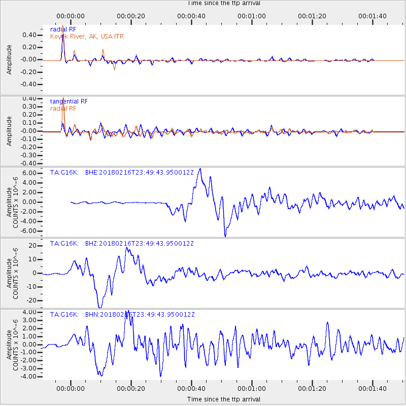
G16K Koyuk River, AK, USA - Earthquake Result Viewer
*The percent match for this event was below the threshold and hence no stack was calculated.
| Earthquake location: |
Oaxaca, Mexico |
| Earthquake latitude/longitude: |
16.4/-97.9 |
| Earthquake time(UTC): |
2018/02/16 (047) 23:39:44 GMT |
| Earthquake Depth: |
43 km |
| Earthquake Magnitude: |
7.5 Mi |
| Earthquake Catalog/Contributor: |
NEIC PDE/at |
|
| Network: |
TA USArray Transportable Network (new EarthScope stations) |
| Station: |
G16K Koyuk River, AK, USA |
| Lat/Lon: |
65.39 N/162.35 W |
| Elevation: |
169 m |
|
| Distance: |
64.7 deg |
| Az: |
335.291 deg |
| Baz: |
106.613 deg |
| Ray Param: |
$rayparam |
*The percent match for this event was below the threshold and hence was not used in the summary stack. |
|
| Radial Match: |
98.640205 % |
| Radial Bump: |
348 |
| Transverse Match: |
91.12104 % |
| Transverse Bump: |
400 |
| SOD ConfigId: |
13570011 |
| Insert Time: |
2019-04-29 20:11:50.089 +0000 |
| GWidth: |
2.5 |
| Max Bumps: |
400 |
| Tol: |
0.001 |
|
Signal To Noise
| Channel | StoN | STA | LTA |
| TA:G16K: :BHZ:20180216T23:49:43.950012Z | 30.654797 | 5.579902E-6 | 1.8202377E-7 |
| TA:G16K: :BHN:20180216T23:49:43.950012Z | 7.201676 | 8.4686826E-7 | 1.1759322E-7 |
| TA:G16K: :BHE:20180216T23:49:43.950012Z | 14.944695 | 1.5345402E-6 | 1.0268126E-7 |
| Arrivals |
| Ps | |
| PpPs | |
| PsPs/PpSs | |


