You are here: Home > Network List > TA - USArray Transportable Network (new EarthScope stations) Stations List
> Station J26L Joseph Creek, AK, USA > Earthquake Result Viewer
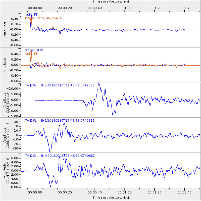
J26L Joseph Creek, AK, USA - Earthquake Result Viewer
*The percent match for this event was below the threshold and hence no stack was calculated.
| Earthquake location: |
Oaxaca, Mexico |
| Earthquake latitude/longitude: |
16.4/-97.9 |
| Earthquake time(UTC): |
2018/02/16 (047) 23:39:44 GMT |
| Earthquake Depth: |
43 km |
| Earthquake Magnitude: |
7.5 Mi |
| Earthquake Catalog/Contributor: |
NEIC PDE/at |
|
| Network: |
TA USArray Transportable Network (new EarthScope stations) |
| Station: |
J26L Joseph Creek, AK, USA |
| Lat/Lon: |
64.50 N/143.56 W |
| Elevation: |
1144 m |
|
| Distance: |
57.1 deg |
| Az: |
338.36 deg |
| Baz: |
125.142 deg |
| Ray Param: |
$rayparam |
*The percent match for this event was below the threshold and hence was not used in the summary stack. |
|
| Radial Match: |
98.63936 % |
| Radial Bump: |
229 |
| Transverse Match: |
92.78964 % |
| Transverse Bump: |
400 |
| SOD ConfigId: |
13570011 |
| Insert Time: |
2019-04-29 20:12:17.458 +0000 |
| GWidth: |
2.5 |
| Max Bumps: |
400 |
| Tol: |
0.001 |
|
Signal To Noise
| Channel | StoN | STA | LTA |
| TA:J26L: :BHZ:20180216T23:48:52.674988Z | 68.32837 | 6.9306434E-6 | 1.01431425E-7 |
| TA:J26L: :BHN:20180216T23:48:52.674988Z | 14.705512 | 1.4629378E-6 | 9.948227E-8 |
| TA:J26L: :BHE:20180216T23:48:52.674988Z | 29.108152 | 3.0713225E-6 | 1.0551416E-7 |
| Arrivals |
| Ps | |
| PpPs | |
| PsPs/PpSs | |


