You are here: Home > Network List > TA - USArray Transportable Network (new EarthScope stations) Stations List
> Station L15K Ungalak Mountain, AK, USA > Earthquake Result Viewer
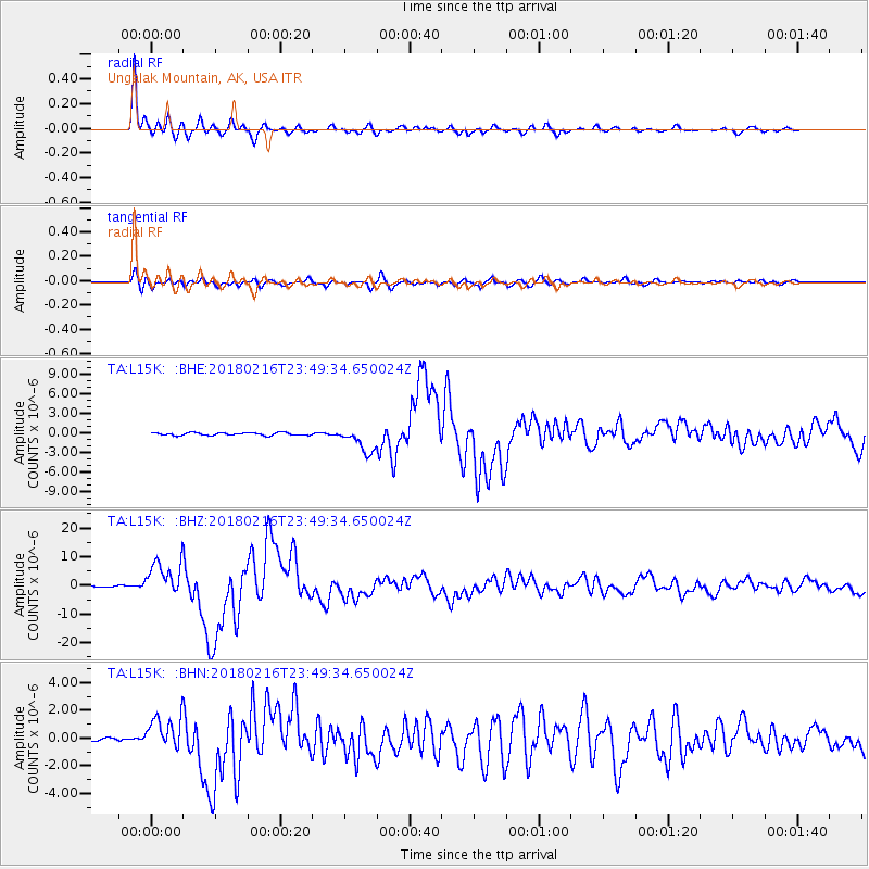
L15K Ungalak Mountain, AK, USA - Earthquake Result Viewer
*The percent match for this event was below the threshold and hence no stack was calculated.
| Earthquake location: |
Oaxaca, Mexico |
| Earthquake latitude/longitude: |
16.4/-97.9 |
| Earthquake time(UTC): |
2018/02/16 (047) 23:39:44 GMT |
| Earthquake Depth: |
43 km |
| Earthquake Magnitude: |
7.5 Mi |
| Earthquake Catalog/Contributor: |
NEIC PDE/at |
|
| Network: |
TA USArray Transportable Network (new EarthScope stations) |
| Station: |
L15K Ungalak Mountain, AK, USA |
| Lat/Lon: |
61.68 N/161.49 W |
| Elevation: |
219 m |
|
| Distance: |
63.2 deg |
| Az: |
331.423 deg |
| Baz: |
105.69 deg |
| Ray Param: |
$rayparam |
*The percent match for this event was below the threshold and hence was not used in the summary stack. |
|
| Radial Match: |
98.16807 % |
| Radial Bump: |
381 |
| Transverse Match: |
87.57235 % |
| Transverse Bump: |
400 |
| SOD ConfigId: |
13570011 |
| Insert Time: |
2019-04-29 20:12:25.246 +0000 |
| GWidth: |
2.5 |
| Max Bumps: |
400 |
| Tol: |
0.001 |
|
Signal To Noise
| Channel | StoN | STA | LTA |
| TA:L15K: :BHZ:20180216T23:49:34.650024Z | 35.600327 | 6.453625E-6 | 1.8127993E-7 |
| TA:L15K: :BHN:20180216T23:49:34.650024Z | 4.851863 | 1.2637144E-6 | 2.6045961E-7 |
| TA:L15K: :BHE:20180216T23:49:34.650024Z | 13.348391 | 2.826998E-6 | 2.117857E-7 |
| Arrivals |
| Ps | |
| PpPs | |
| PsPs/PpSs | |


