You are here: Home > Network List > TA - USArray Transportable Network (new EarthScope stations) Stations List
> Station M31M Drury Creek, Yukon, CA > Earthquake Result Viewer
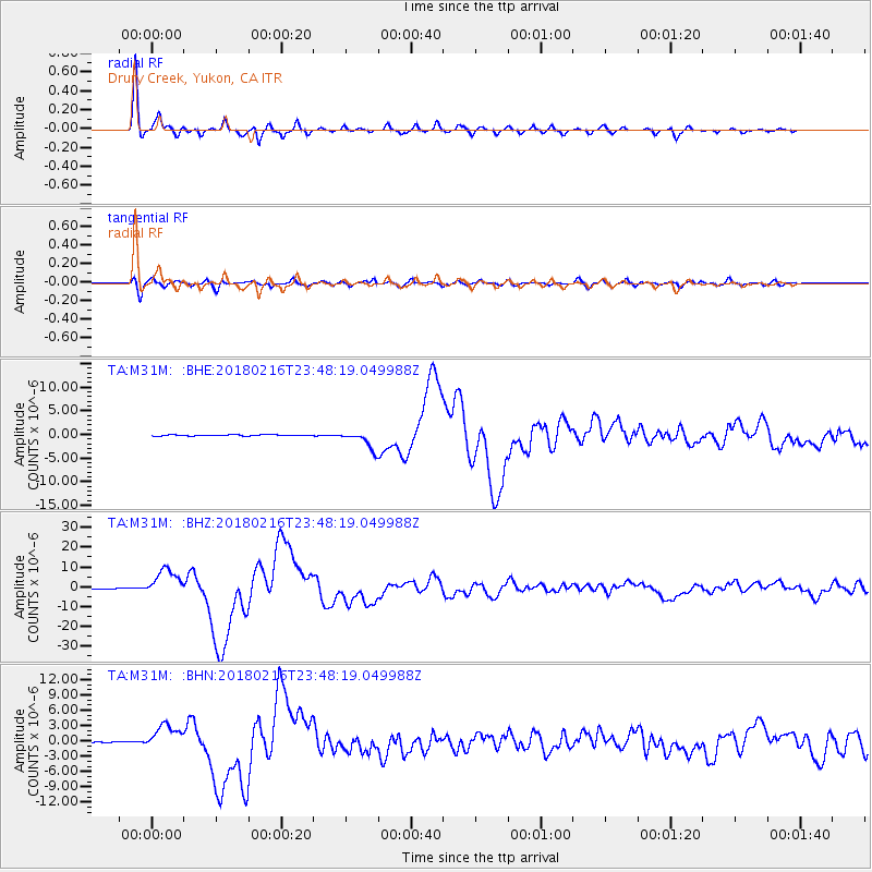
M31M Drury Creek, Yukon, CA - Earthquake Result Viewer
*The percent match for this event was below the threshold and hence no stack was calculated.
| Earthquake location: |
Oaxaca, Mexico |
| Earthquake latitude/longitude: |
16.4/-97.9 |
| Earthquake time(UTC): |
2018/02/16 (047) 23:39:44 GMT |
| Earthquake Depth: |
43 km |
| Earthquake Magnitude: |
7.5 Mi |
| Earthquake Catalog/Contributor: |
NEIC PDE/at |
|
| Network: |
TA USArray Transportable Network (new EarthScope stations) |
| Station: |
M31M Drury Creek, Yukon, CA |
| Lat/Lon: |
62.20 N/134.39 W |
| Elevation: |
639 m |
|
| Distance: |
52.4 deg |
| Az: |
339.409 deg |
| Baz: |
133.94 deg |
| Ray Param: |
$rayparam |
*The percent match for this event was below the threshold and hence was not used in the summary stack. |
|
| Radial Match: |
98.40175 % |
| Radial Bump: |
317 |
| Transverse Match: |
85.78912 % |
| Transverse Bump: |
400 |
| SOD ConfigId: |
13570011 |
| Insert Time: |
2019-04-29 20:12:42.986 +0000 |
| GWidth: |
2.5 |
| Max Bumps: |
400 |
| Tol: |
0.001 |
|
Signal To Noise
| Channel | StoN | STA | LTA |
| TA:M31M: :BHZ:20180216T23:48:19.049988Z | 40.44118 | 6.820125E-6 | 1.6864307E-7 |
| TA:M31M: :BHN:20180216T23:48:19.049988Z | 26.974724 | 2.4318338E-6 | 9.015232E-8 |
| TA:M31M: :BHE:20180216T23:48:19.049988Z | 25.411854 | 2.9557928E-6 | 1.1631551E-7 |
| Arrivals |
| Ps | |
| PpPs | |
| PsPs/PpSs | |


