You are here: Home > Network List > TA - USArray Transportable Network (new EarthScope stations) Stations List
> Station R33M Jennings River, BC, CAN > Earthquake Result Viewer
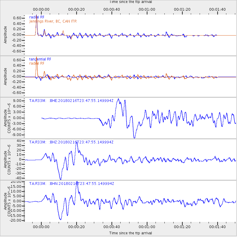
R33M Jennings River, BC, CAN - Earthquake Result Viewer
*The percent match for this event was below the threshold and hence no stack was calculated.
| Earthquake location: |
Oaxaca, Mexico |
| Earthquake latitude/longitude: |
16.4/-97.9 |
| Earthquake time(UTC): |
2018/02/16 (047) 23:39:44 GMT |
| Earthquake Depth: |
43 km |
| Earthquake Magnitude: |
7.5 Mi |
| Earthquake Catalog/Contributor: |
NEIC PDE/at |
|
| Network: |
TA USArray Transportable Network (new EarthScope stations) |
| Station: |
R33M Jennings River, BC, CAN |
| Lat/Lon: |
59.39 N/130.97 W |
| Elevation: |
1437 m |
|
| Distance: |
49.3 deg |
| Az: |
338.379 deg |
| Baz: |
136.274 deg |
| Ray Param: |
$rayparam |
*The percent match for this event was below the threshold and hence was not used in the summary stack. |
|
| Radial Match: |
98.50802 % |
| Radial Bump: |
316 |
| Transverse Match: |
92.416115 % |
| Transverse Bump: |
400 |
| SOD ConfigId: |
13570011 |
| Insert Time: |
2019-04-29 20:13:12.667 +0000 |
| GWidth: |
2.5 |
| Max Bumps: |
400 |
| Tol: |
0.001 |
|
Signal To Noise
| Channel | StoN | STA | LTA |
| TA:R33M: :BHZ:20180216T23:47:55.149994Z | 46.208977 | 7.2691264E-6 | 1.5730984E-7 |
| TA:R33M: :BHN:20180216T23:47:55.149994Z | 19.599112 | 3.4687682E-6 | 1.7698599E-7 |
| TA:R33M: :BHE:20180216T23:47:55.149994Z | 21.061686 | 2.266514E-6 | 1.0761313E-7 |
| Arrivals |
| Ps | |
| PpPs | |
| PsPs/PpSs | |


