You are here: Home > Network List > UW - Pacific Northwest Regional Seismic Network Stations List
> Station FISH Seaside, OR, USA > Earthquake Result Viewer
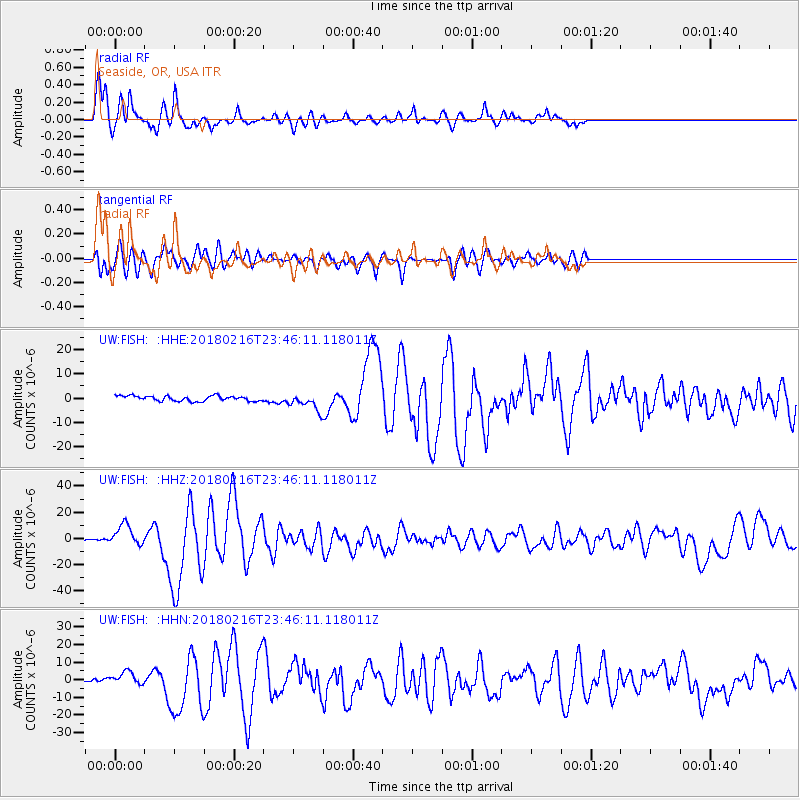
FISH Seaside, OR, USA - Earthquake Result Viewer
*The percent match for this event was below the threshold and hence no stack was calculated.
| Earthquake location: |
Oaxaca, Mexico |
| Earthquake latitude/longitude: |
16.4/-97.9 |
| Earthquake time(UTC): |
2018/02/16 (047) 23:39:44 GMT |
| Earthquake Depth: |
43 km |
| Earthquake Magnitude: |
7.5 Mi |
| Earthquake Catalog/Contributor: |
NEIC PDE/at |
|
| Network: |
UW Pacific Northwest Regional Seismic Network |
| Station: |
FISH Seaside, OR, USA |
| Lat/Lon: |
45.93 N/123.56 W |
| Elevation: |
325 m |
|
| Distance: |
36.4 deg |
| Az: |
329.392 deg |
| Baz: |
135.556 deg |
| Ray Param: |
$rayparam |
*The percent match for this event was below the threshold and hence was not used in the summary stack. |
|
| Radial Match: |
88.08302 % |
| Radial Bump: |
400 |
| Transverse Match: |
77.43737 % |
| Transverse Bump: |
400 |
| SOD ConfigId: |
13570011 |
| Insert Time: |
2019-04-29 20:14:06.761 +0000 |
| GWidth: |
2.5 |
| Max Bumps: |
400 |
| Tol: |
0.001 |
|
Signal To Noise
| Channel | StoN | STA | LTA |
| UW:FISH: :HHZ:20180216T23:46:11.118011Z | 12.125271 | 8.1237995E-6 | 6.699891E-7 |
| UW:FISH: :HHN:20180216T23:46:11.118011Z | 3.0856366 | 3.6851293E-6 | 1.1942849E-6 |
| UW:FISH: :HHE:20180216T23:46:11.118011Z | 4.0950966 | 4.5378997E-6 | 1.10813E-6 |
| Arrivals |
| Ps | |
| PpPs | |
| PsPs/PpSs | |


