You are here: Home > Network List > UW - Pacific Northwest Regional Seismic Network Stations List
> Station LEBA Lebam, WA, USA > Earthquake Result Viewer
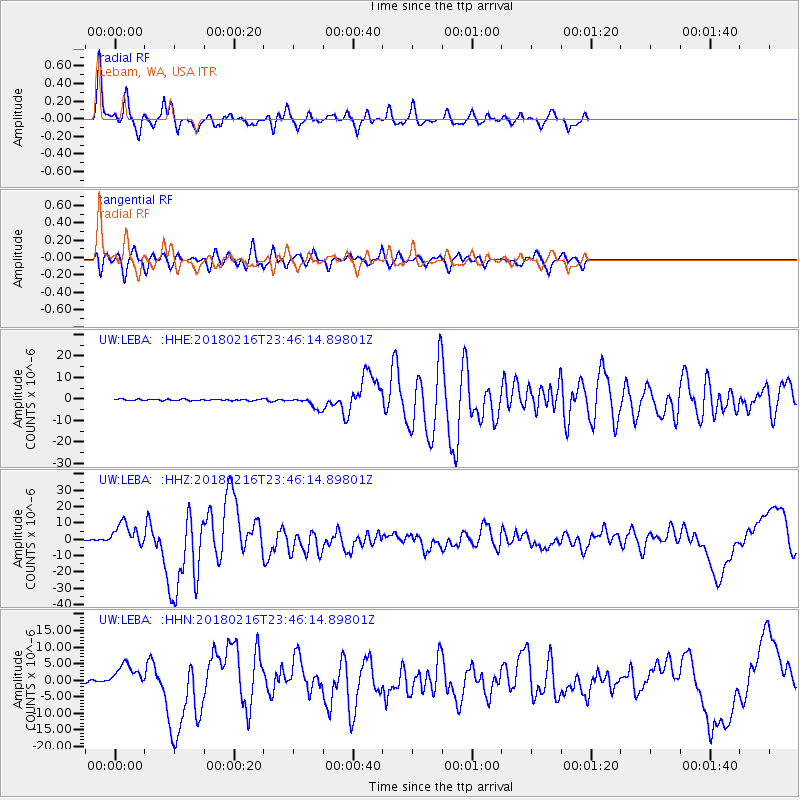
LEBA Lebam, WA, USA - Earthquake Result Viewer
*The percent match for this event was below the threshold and hence no stack was calculated.
| Earthquake location: |
Oaxaca, Mexico |
| Earthquake latitude/longitude: |
16.4/-97.9 |
| Earthquake time(UTC): |
2018/02/16 (047) 23:39:44 GMT |
| Earthquake Depth: |
43 km |
| Earthquake Magnitude: |
7.5 Mi |
| Earthquake Catalog/Contributor: |
NEIC PDE/at |
|
| Network: |
UW Pacific Northwest Regional Seismic Network |
| Station: |
LEBA Lebam, WA, USA |
| Lat/Lon: |
46.55 N/123.56 W |
| Elevation: |
73 m |
|
| Distance: |
36.9 deg |
| Az: |
330.107 deg |
| Baz: |
136.127 deg |
| Ray Param: |
$rayparam |
*The percent match for this event was below the threshold and hence was not used in the summary stack. |
|
| Radial Match: |
88.0799 % |
| Radial Bump: |
330 |
| Transverse Match: |
84.52108 % |
| Transverse Bump: |
400 |
| SOD ConfigId: |
13570011 |
| Insert Time: |
2019-04-29 20:14:15.577 +0000 |
| GWidth: |
2.5 |
| Max Bumps: |
400 |
| Tol: |
0.001 |
|
Signal To Noise
| Channel | StoN | STA | LTA |
| UW:LEBA: :HHZ:20180216T23:46:14.89801Z | 28.255178 | 7.2616463E-6 | 2.570023E-7 |
| UW:LEBA: :HHN:20180216T23:46:14.89801Z | 10.296816 | 3.574583E-6 | 3.471542E-7 |
| UW:LEBA: :HHE:20180216T23:46:14.89801Z | 8.563958 | 3.179107E-6 | 3.7121933E-7 |
| Arrivals |
| Ps | |
| PpPs | |
| PsPs/PpSs | |


