You are here: Home > Network List > UW - Pacific Northwest Regional Seismic Network Stations List
> Station UMAT Pilot Rock, OR, USA > Earthquake Result Viewer
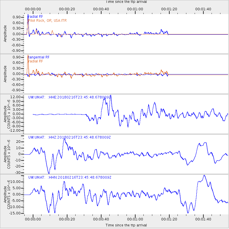
UMAT Pilot Rock, OR, USA - Earthquake Result Viewer
*The percent match for this event was below the threshold and hence no stack was calculated.
| Earthquake location: |
Oaxaca, Mexico |
| Earthquake latitude/longitude: |
16.4/-97.9 |
| Earthquake time(UTC): |
2018/02/16 (047) 23:39:44 GMT |
| Earthquake Depth: |
43 km |
| Earthquake Magnitude: |
7.5 Mi |
| Earthquake Catalog/Contributor: |
NEIC PDE/at |
|
| Network: |
UW Pacific Northwest Regional Seismic Network |
| Station: |
UMAT Pilot Rock, OR, USA |
| Lat/Lon: |
45.29 N/118.96 W |
| Elevation: |
1318 m |
|
| Distance: |
33.8 deg |
| Az: |
332.868 deg |
| Baz: |
141.678 deg |
| Ray Param: |
$rayparam |
*The percent match for this event was below the threshold and hence was not used in the summary stack. |
|
| Radial Match: |
95.55251 % |
| Radial Bump: |
351 |
| Transverse Match: |
71.55285 % |
| Transverse Bump: |
400 |
| SOD ConfigId: |
13570011 |
| Insert Time: |
2019-04-29 20:14:31.235 +0000 |
| GWidth: |
2.5 |
| Max Bumps: |
400 |
| Tol: |
0.001 |
|
Signal To Noise
| Channel | StoN | STA | LTA |
| UW:UMAT: :HHZ:20180216T23:45:48.678009Z | 58.237034 | 6.890739E-6 | 1.1832228E-7 |
| UW:UMAT: :HHN:20180216T23:45:48.678009Z | 31.210184 | 3.6161564E-6 | 1.1586463E-7 |
| UW:UMAT: :HHE:20180216T23:45:48.678009Z | 26.76882 | 3.4074596E-6 | 1.2729211E-7 |
| Arrivals |
| Ps | |
| PpPs | |
| PsPs/PpSs | |


