Y12C Blythe, CA, USA - Earthquake Result Viewer
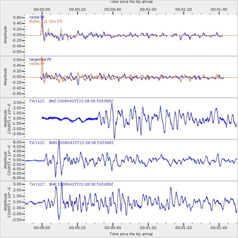
Earthquake location: Andreanof Islands, Aleutian Is.
Earthquake latitude/longitude: 51.9/-179.4
Earthquake time(UTC): 2008/04/15 (106) 22:59:51 GMT
Earthquake Depth: 10 km
Earthquake Magnitude: 6.1 MB, 6.4 MS, 6.4 MW, 6.4 MW
Earthquake Catalog/Contributor: WHDF/NEIC
Network: TA USArray Transportable Network (new EarthScope stations)
Station: Y12C Blythe, CA, USA
Lat/Lon: 33.75 N/114.52 W
Elevation: 196 m
Distance: 49.2 deg
Az: 85.069 deg
Baz: 312.127 deg
Ray Param: 0.06885809
Estimated Moho Depth: 51.5 km
Estimated Crust Vp/Vs: 1.60
Assumed Crust Vp: 6.155 km/s
Estimated Crust Vs: 3.847 km/s
Estimated Crust Poisson's Ratio: 0.18
Radial Match: 89.431854 %
Radial Bump: 400
Transverse Match: 75.5406 %
Transverse Bump: 400
SOD ConfigId: 2504
Insert Time: 2010-03-06 09:12:49.670 +0000
GWidth: 2.5
Max Bumps: 400
Tol: 0.001

Signal To Noise

ChannelStoNSTALTA
TA:Y12C: :BHN:20080415T23:08:08.593988Z10.7300081.179284E-61.0990523E-7
TA:Y12C: :BHE:20080415T23:08:08.593988Z2.42711834.7820805E-71.9702709E-7
TA:Y12C: :BHZ:20080415T23:08:08.593988Z2.36128645.807799E-72.4595911E-7
Arrivals
Ps5.3 SECOND
PpPs20 SECOND
PsPs/PpSs26 SECOND