You are here: Home > Network List > TA - USArray Transportable Network (new EarthScope stations) Stations List
> Station H16K Elim, AK, USA > Earthquake Result Viewer
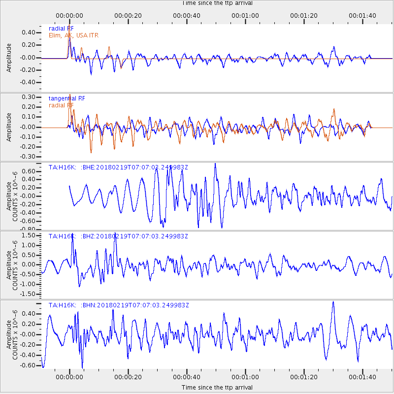
H16K Elim, AK, USA - Earthquake Result Viewer
*The percent match for this event was below the threshold and hence no stack was calculated.
| Earthquake location: |
Oaxaca, Mexico |
| Earthquake latitude/longitude: |
16.5/-97.6 |
| Earthquake time(UTC): |
2018/02/19 (050) 06:57:01 GMT |
| Earthquake Depth: |
40 km |
| Earthquake Magnitude: |
5.9 Mww |
| Earthquake Catalog/Contributor: |
NEIC PDE/us |
|
| Network: |
TA USArray Transportable Network (new EarthScope stations) |
| Station: |
H16K Elim, AK, USA |
| Lat/Lon: |
64.64 N/162.24 W |
| Elevation: |
216 m |
|
| Distance: |
64.4 deg |
| Az: |
334.437 deg |
| Baz: |
106.023 deg |
| Ray Param: |
$rayparam |
*The percent match for this event was below the threshold and hence was not used in the summary stack. |
|
| Radial Match: |
56.03969 % |
| Radial Bump: |
400 |
| Transverse Match: |
56.735737 % |
| Transverse Bump: |
400 |
| SOD ConfigId: |
13570011 |
| Insert Time: |
2019-04-29 20:26:24.192 +0000 |
| GWidth: |
2.5 |
| Max Bumps: |
400 |
| Tol: |
0.001 |
|
Signal To Noise
| Channel | StoN | STA | LTA |
| TA:H16K: :BHZ:20180219T07:07:03.249983Z | 3.360363 | 6.511729E-7 | 1.9378051E-7 |
| TA:H16K: :BHN:20180219T07:07:03.249983Z | 1.0176961 | 2.4946237E-7 | 2.4512462E-7 |
| TA:H16K: :BHE:20180219T07:07:03.249983Z | 2.7383575 | 5.52208E-7 | 2.0165665E-7 |
| Arrivals |
| Ps | |
| PpPs | |
| PsPs/PpSs | |


