You are here: Home > Network List > TA - USArray Transportable Network (new EarthScope stations) Stations List
> Station Y12C Blythe, CA, USA > Earthquake Result Viewer
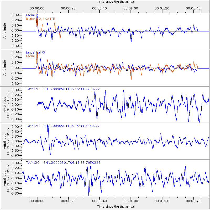
Y12C Blythe, CA, USA - Earthquake Result Viewer
*The percent match for this event was below the threshold and hence no stack was calculated.
| Earthquake location: |
Solomon Islands |
| Earthquake latitude/longitude: |
-10.8/162.2 |
| Earthquake time(UTC): |
2009/05/01 (121) 06:03:05 GMT |
| Earthquake Depth: |
21 km |
| Earthquake Magnitude: |
5.9 MB, 5.6 MS, 5.9 MW, 5.9 MW |
| Earthquake Catalog/Contributor: |
WHDF/NEIC |
|
| Network: |
TA USArray Transportable Network (new EarthScope stations) |
| Station: |
Y12C Blythe, CA, USA |
| Lat/Lon: |
33.75 N/114.52 W |
| Elevation: |
196 m |
|
| Distance: |
90.4 deg |
| Az: |
55.837 deg |
| Baz: |
257.379 deg |
| Ray Param: |
$rayparam |
*The percent match for this event was below the threshold and hence was not used in the summary stack. |
|
| Radial Match: |
73.17491 % |
| Radial Bump: |
400 |
| Transverse Match: |
65.15458 % |
| Transverse Bump: |
400 |
| SOD ConfigId: |
2658 |
| Insert Time: |
2010-03-06 09:15:31.332 +0000 |
| GWidth: |
2.5 |
| Max Bumps: |
400 |
| Tol: |
0.001 |
|
Signal To Noise
| Channel | StoN | STA | LTA |
| TA:Y12C: :BHZ:20090501T06:15:33.795022Z | 2.4441059 | 2.1660503E-7 | 8.862342E-8 |
| TA:Y12C: :BHN:20090501T06:15:33.795022Z | 0.9732904 | 6.0973825E-8 | 6.26471E-8 |
| TA:Y12C: :BHE:20090501T06:15:33.795022Z | 1.6089844 | 9.58252E-8 | 5.9556328E-8 |
| Arrivals |
| Ps | |
| PpPs | |
| PsPs/PpSs | |


