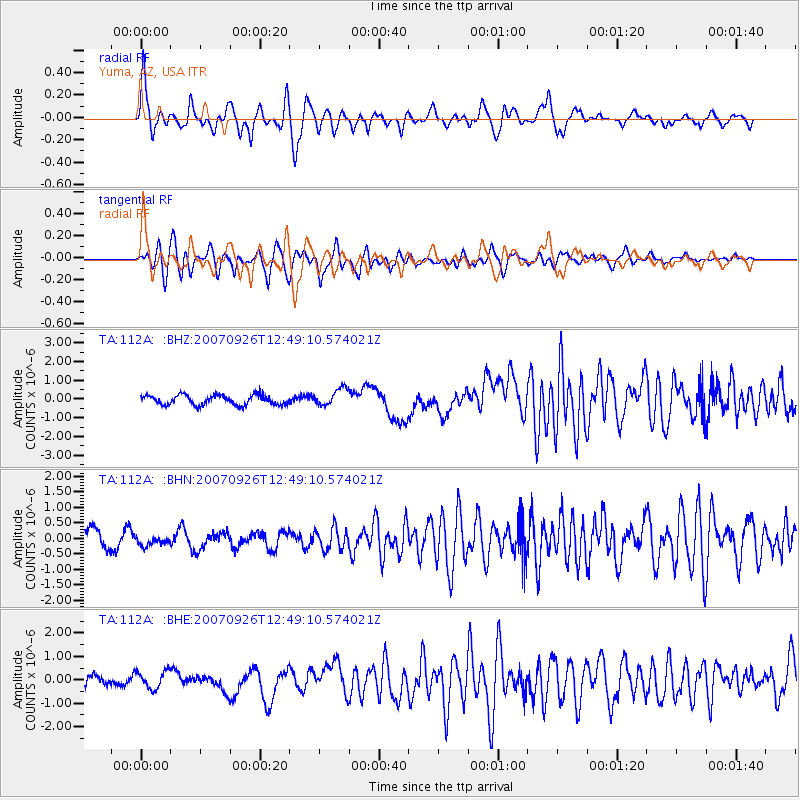
112A Yuma, AZ, USA - Earthquake Result Viewer
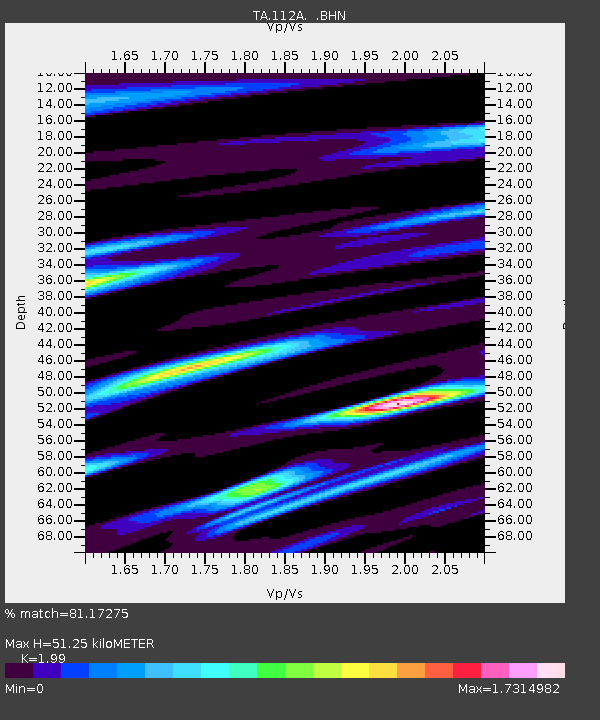
Earthquake location: New Ireland Region, P.N.G.
Earthquake latitude/longitude: -5.0/153.5
Earthquake time(UTC): 2007/09/26 (269) 12:36:26 GMT
Earthquake Depth: 40 km
Earthquake Magnitude: 6.2 MB, 6.6 MS, 6.7 MW, 6.7 MW
Earthquake Catalog/Contributor: WHDF/NEIC
Network: TA USArray Transportable Network (new EarthScope stations)
Station: 112A Yuma, AZ, USA
Lat/Lon: 32.54 N/114.58 W
Elevation: 87 m
Distance: 94.3 deg
Az: 57.84 deg
Baz: 266.831 deg
Ray Param: 0.041065346
Estimated Moho Depth: 51.25 km
Estimated Crust Vp/Vs: 1.99
Assumed Crust Vp: 6.155 km/s
Estimated Crust Vs: 3.093 km/s
Estimated Crust Poisson's Ratio: 0.33
Radial Match: 81.17275 %
Radial Bump: 400
Transverse Match: 87.62599 %
Transverse Bump: 400
SOD ConfigId: 2564
Insert Time: 2010-03-06 09:16:40.103 +0000
GWidth: 2.5
Max Bumps: 400
Tol: 0.001

Signal To Noise

ChannelStoNSTALTA
TA:112A: :BHN:20070926T12:49:10.574021Z0.48749511.3348121E-72.7381034E-7
TA:112A: :BHE:20070926T12:49:10.574021Z0.79977733.7711175E-74.715209E-7
TA:112A: :BHZ:20070926T12:49:10.574021Z1.7560324.5519764E-72.5921943E-7
Arrivals
Ps8.4 SECOND
PpPs24 SECOND
PsPs/PpSs33 SECOND