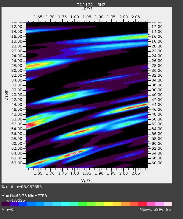
112A Yuma, AZ, USA - Earthquake Result Viewer

Earthquake location: Andreanof Islands, Aleutian Is.
Earthquake latitude/longitude: 51.9/-177.5
Earthquake time(UTC): 2008/05/02 (123) 01:33:37 GMT
Earthquake Depth: 14 km
Earthquake Magnitude: 6.3 MB, 6.8 MS, 6.6 MW, 6.6 MW
Earthquake Catalog/Contributor: WHDF/NEIC
Network: TA USArray Transportable Network (new EarthScope stations)
Station: 112A Yuma, AZ, USA
Lat/Lon: 32.54 N/114.58 W
Elevation: 87 m
Distance: 48.8 deg
Az: 87.677 deg
Baz: 312.819 deg
Ray Param: 0.06908185
Estimated Moho Depth: 63.75 km
Estimated Crust Vp/Vs: 1.80
Assumed Crust Vp: 6.155 km/s
Estimated Crust Vs: 3.414 km/s
Estimated Crust Poisson's Ratio: 0.28
Radial Match: 93.082695 %
Radial Bump: 369
Transverse Match: 81.40309 %
Transverse Bump: 400
SOD ConfigId: 2504
Insert Time: 2010-03-06 09:17:25.207 +0000
GWidth: 2.5
Max Bumps: 400
Tol: 0.001

Signal To Noise

ChannelStoNSTALTA
TA:112A: :BHZ:20080502T01:41:51.150004Z4.28453161.8142928E-64.234518E-7
TA:112A: :BHN:20080502T01:41:51.150004Z2.4413219.606676E-73.9350323E-7
TA:112A: :BHE:20080502T01:41:51.150004Z1.80287445.1636556E-72.864124E-7
Arrivals
Ps8.8 SECOND
PpPs28 SECOND
PsPs/PpSs36 SECOND