You are here: Home > Network List > AV - Alaska Volcano Observatory Stations List
> Station MAPS Pakushin Southeast, Makushin Volcano, Alaska > Earthquake Result Viewer
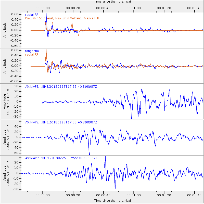
MAPS Pakushin Southeast, Makushin Volcano, Alaska - Earthquake Result Viewer
*The percent match for this event was below the threshold and hence no stack was calculated.
| Earthquake location: |
New Guinea, Papua New Guinea |
| Earthquake latitude/longitude: |
-6.2/142.8 |
| Earthquake time(UTC): |
2018/02/25 (056) 17:44:39 GMT |
| Earthquake Depth: |
10 km |
| Earthquake Magnitude: |
7.6 Mi |
| Earthquake Catalog/Contributor: |
NEIC PDE/at |
|
| Network: |
AV Alaska Volcano Observatory |
| Station: |
MAPS Pakushin Southeast, Makushin Volcano, Alaska |
| Lat/Lon: |
53.81 N/166.94 W |
| Elevation: |
333 m |
|
| Distance: |
73.1 deg |
| Az: |
28.464 deg |
| Baz: |
233.033 deg |
| Ray Param: |
$rayparam |
*The percent match for this event was below the threshold and hence was not used in the summary stack. |
|
| Radial Match: |
95.47554 % |
| Radial Bump: |
400 |
| Transverse Match: |
90.82612 % |
| Transverse Bump: |
400 |
| SOD ConfigId: |
13570011 |
| Insert Time: |
2019-04-29 20:39:36.539 +0000 |
| GWidth: |
2.5 |
| Max Bumps: |
400 |
| Tol: |
0.001 |
|
Signal To Noise
| Channel | StoN | STA | LTA |
| AV:MAPS: :BHZ:20180225T17:55:40.398987Z | 2.3377323 | 2.2378306E-6 | 9.572656E-7 |
| AV:MAPS: :BHN:20180225T17:55:40.398987Z | 1.3021581 | 9.2681216E-7 | 7.1175083E-7 |
| AV:MAPS: :BHE:20180225T17:55:40.398987Z | 1.6331196 | 1.5113133E-6 | 9.254149E-7 |
| Arrivals |
| Ps | |
| PpPs | |
| PsPs/PpSs | |


