You are here: Home > Network List > TA - USArray Transportable Network (new EarthScope stations) Stations List
> Station 112A Yuma, AZ, USA > Earthquake Result Viewer
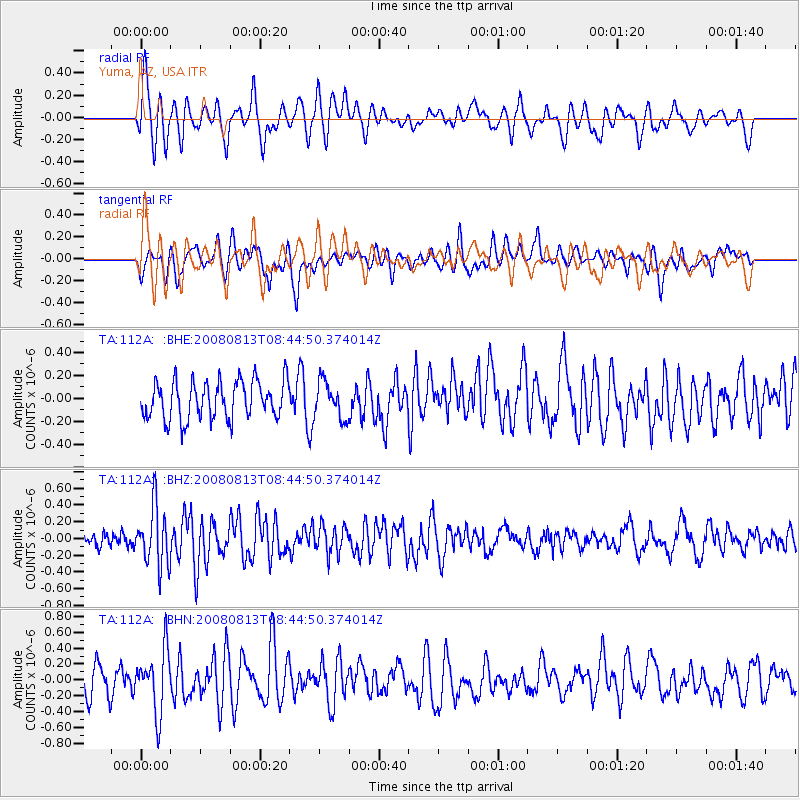
112A Yuma, AZ, USA - Earthquake Result Viewer
*The percent match for this event was below the threshold and hence no stack was calculated.
| Earthquake location: |
North Of Severnaya Zemlya |
| Earthquake latitude/longitude: |
83.6/115.2 |
| Earthquake time(UTC): |
2008/08/13 (226) 08:35:02 GMT |
| Earthquake Depth: |
10 km |
| Earthquake Magnitude: |
5.5 MB, 4.7 MS, 5.4 MW, 5.4 MW |
| Earthquake Catalog/Contributor: |
WHDF/NEIC |
|
| Network: |
TA USArray Transportable Network (new EarthScope stations) |
| Station: |
112A Yuma, AZ, USA |
| Lat/Lon: |
32.54 N/114.58 W |
| Elevation: |
87 m |
|
| Distance: |
61.9 deg |
| Az: |
47.031 deg |
| Baz: |
354.458 deg |
| Ray Param: |
$rayparam |
*The percent match for this event was below the threshold and hence was not used in the summary stack. |
|
| Radial Match: |
60.68433 % |
| Radial Bump: |
400 |
| Transverse Match: |
50.94758 % |
| Transverse Bump: |
400 |
| SOD ConfigId: |
2504 |
| Insert Time: |
2010-03-06 09:17:59.045 +0000 |
| GWidth: |
2.5 |
| Max Bumps: |
400 |
| Tol: |
0.001 |
|
Signal To Noise
| Channel | StoN | STA | LTA |
| TA:112A: :BHZ:20080813T08:44:50.374014Z | 3.1582785 | 3.521573E-7 | 1.1150292E-7 |
| TA:112A: :BHN:20080813T08:44:50.374014Z | 1.9251271 | 3.9196013E-7 | 2.0360221E-7 |
| TA:112A: :BHE:20080813T08:44:50.374014Z | 0.96262956 | 1.5945712E-7 | 1.6564744E-7 |
| Arrivals |
| Ps | |
| PpPs | |
| PsPs/PpSs | |


