You are here: Home > Network List > TA - USArray Transportable Network (new EarthScope stations) Stations List
> Station I30M Mount Dempster, Yukon, CAN > Earthquake Result Viewer
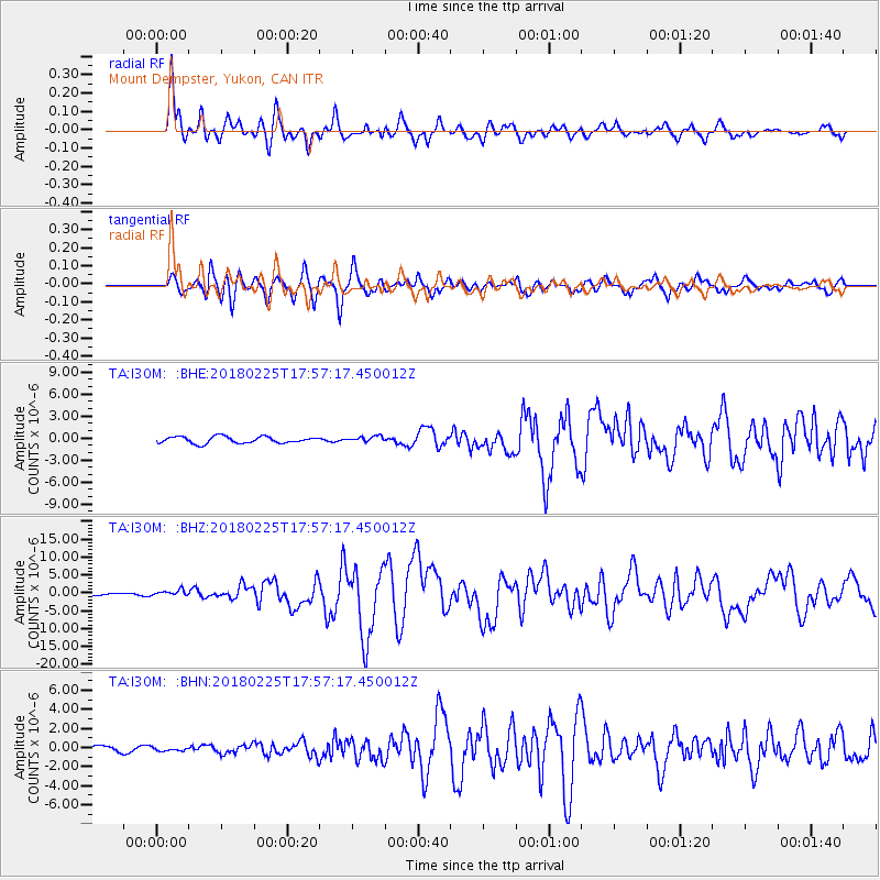
I30M Mount Dempster, Yukon, CAN - Earthquake Result Viewer
*The percent match for this event was below the threshold and hence no stack was calculated.
| Earthquake location: |
New Guinea, Papua New Guinea |
| Earthquake latitude/longitude: |
-6.2/142.8 |
| Earthquake time(UTC): |
2018/02/25 (056) 17:44:39 GMT |
| Earthquake Depth: |
10 km |
| Earthquake Magnitude: |
7.6 Mi |
| Earthquake Catalog/Contributor: |
NEIC PDE/at |
|
| Network: |
TA USArray Transportable Network (new EarthScope stations) |
| Station: |
I30M Mount Dempster, Yukon, CAN |
| Lat/Lon: |
65.22 N/136.38 W |
| Elevation: |
1399 m |
|
| Distance: |
91.7 deg |
| Az: |
24.596 deg |
| Baz: |
259.1 deg |
| Ray Param: |
$rayparam |
*The percent match for this event was below the threshold and hence was not used in the summary stack. |
|
| Radial Match: |
91.80479 % |
| Radial Bump: |
400 |
| Transverse Match: |
87.16802 % |
| Transverse Bump: |
400 |
| SOD ConfigId: |
13570011 |
| Insert Time: |
2019-04-29 20:42:22.266 +0000 |
| GWidth: |
2.5 |
| Max Bumps: |
400 |
| Tol: |
0.001 |
|
Signal To Noise
| Channel | StoN | STA | LTA |
| TA:I30M: :BHZ:20180225T17:57:17.450012Z | 1.8182946 | 7.7167044E-7 | 4.243924E-7 |
| TA:I30M: :BHN:20180225T17:57:17.450012Z | 0.49113238 | 1.6823158E-7 | 3.4253816E-7 |
| TA:I30M: :BHE:20180225T17:57:17.450012Z | 0.48093018 | 2.2388001E-7 | 4.6551457E-7 |
| Arrivals |
| Ps | |
| PpPs | |
| PsPs/PpSs | |


