You are here: Home > Network List > CN - Canadian National Seismograph Network Stations List
> Station INK INUVIK, NT > Earthquake Result Viewer
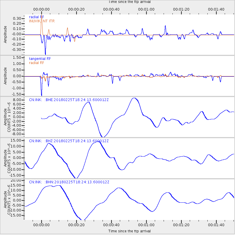
INK INUVIK, NT - Earthquake Result Viewer
*The percent match for this event was below the threshold and hence no stack was calculated.
| Earthquake location: |
New Guinea, Papua New Guinea |
| Earthquake latitude/longitude: |
-5.8/142.2 |
| Earthquake time(UTC): |
2018/02/25 (056) 18:11:34 GMT |
| Earthquake Depth: |
39 km |
| Earthquake Magnitude: |
5.5 mb |
| Earthquake Catalog/Contributor: |
NEIC PDE/us |
|
| Network: |
CN Canadian National Seismograph Network |
| Station: |
INK INUVIK, NT |
| Lat/Lon: |
68.31 N/133.53 W |
| Elevation: |
44 m |
|
| Distance: |
93.2 deg |
| Az: |
21.745 deg |
| Baz: |
262.523 deg |
| Ray Param: |
$rayparam |
*The percent match for this event was below the threshold and hence was not used in the summary stack. |
|
| Radial Match: |
79.05215 % |
| Radial Bump: |
400 |
| Transverse Match: |
61.61728 % |
| Transverse Bump: |
400 |
| SOD ConfigId: |
13570011 |
| Insert Time: |
2019-04-29 20:44:57.218 +0000 |
| GWidth: |
2.5 |
| Max Bumps: |
400 |
| Tol: |
0.001 |
|
Signal To Noise
| Channel | StoN | STA | LTA |
| CN:INK: :BHZ:20180225T18:24:13.600012Z | 2.4176955 | 9.605699E-6 | 3.9730808E-6 |
| CN:INK: :BHN:20180225T18:24:13.600012Z | 5.0487037 | 1.810028E-5 | 3.5851342E-6 |
| CN:INK: :BHE:20180225T18:24:13.600012Z | 2.7075305 | 4.9228747E-6 | 1.8182159E-6 |
| Arrivals |
| Ps | |
| PpPs | |
| PsPs/PpSs | |


