You are here: Home > Network List > TA - USArray Transportable Network (new EarthScope stations) Stations List
> Station G31M Satah River, YT, CAN > Earthquake Result Viewer
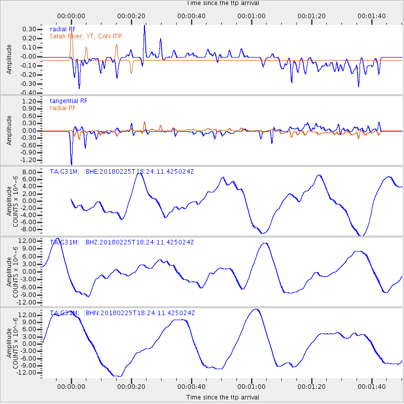
G31M Satah River, YT, CAN - Earthquake Result Viewer
*The percent match for this event was below the threshold and hence no stack was calculated.
| Earthquake location: |
New Guinea, Papua New Guinea |
| Earthquake latitude/longitude: |
-5.8/142.2 |
| Earthquake time(UTC): |
2018/02/25 (056) 18:11:34 GMT |
| Earthquake Depth: |
39 km |
| Earthquake Magnitude: |
5.5 mb |
| Earthquake Catalog/Contributor: |
NEIC PDE/us |
|
| Network: |
TA USArray Transportable Network (new EarthScope stations) |
| Station: |
G31M Satah River, YT, CAN |
| Lat/Lon: |
66.92 N/134.27 W |
| Elevation: |
61 m |
|
| Distance: |
92.7 deg |
| Az: |
23.085 deg |
| Baz: |
261.766 deg |
| Ray Param: |
$rayparam |
*The percent match for this event was below the threshold and hence was not used in the summary stack. |
|
| Radial Match: |
62.162613 % |
| Radial Bump: |
400 |
| Transverse Match: |
60.37614 % |
| Transverse Bump: |
400 |
| SOD ConfigId: |
13570011 |
| Insert Time: |
2019-04-29 20:46:12.669 +0000 |
| GWidth: |
2.5 |
| Max Bumps: |
400 |
| Tol: |
0.001 |
|
Signal To Noise
| Channel | StoN | STA | LTA |
| TA:G31M: :BHZ:20180225T18:24:11.425024Z | 1.3082821 | 7.167336E-6 | 5.478433E-6 |
| TA:G31M: :BHN:20180225T18:24:11.425024Z | 2.4443448 | 1.3733951E-5 | 5.618664E-6 |
| TA:G31M: :BHE:20180225T18:24:11.425024Z | 0.71715724 | 2.5234438E-6 | 3.5186756E-6 |
| Arrivals |
| Ps | |
| PpPs | |
| PsPs/PpSs | |


