You are here: Home > Network List > CI - Caltech Regional Seismic Network Stations List
> Station MPM Manuel Prospect Mine, California, USA > Earthquake Result Viewer
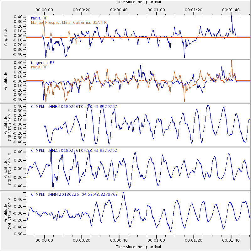
MPM Manuel Prospect Mine, California, USA - Earthquake Result Viewer
*The percent match for this event was below the threshold and hence no stack was calculated.
| Earthquake location: |
New Britain Region, P.N.G. |
| Earthquake latitude/longitude: |
-5.4/151.8 |
| Earthquake time(UTC): |
2018/02/26 (057) 04:41:02 GMT |
| Earthquake Depth: |
35 km |
| Earthquake Magnitude: |
5.6 Mww |
| Earthquake Catalog/Contributor: |
NEIC PDE/us |
|
| Network: |
CI Caltech Regional Seismic Network |
| Station: |
MPM Manuel Prospect Mine, California, USA |
| Lat/Lon: |
36.06 N/117.49 W |
| Elevation: |
185 m |
|
| Distance: |
93.7 deg |
| Az: |
54.285 deg |
| Baz: |
266.03 deg |
| Ray Param: |
$rayparam |
*The percent match for this event was below the threshold and hence was not used in the summary stack. |
|
| Radial Match: |
60.168137 % |
| Radial Bump: |
400 |
| Transverse Match: |
54.387127 % |
| Transverse Bump: |
400 |
| SOD ConfigId: |
13570011 |
| Insert Time: |
2019-04-29 20:48:39.921 +0000 |
| GWidth: |
2.5 |
| Max Bumps: |
400 |
| Tol: |
0.001 |
|
Signal To Noise
| Channel | StoN | STA | LTA |
| CI:MPM: :HHZ:20180226T04:53:43.827976Z | 1.3736917 | 2.0751432E-7 | 1.5106325E-7 |
| CI:MPM: :HHN:20180226T04:53:43.827976Z | 0.25782025 | 4.724719E-8 | 1.8325633E-7 |
| CI:MPM: :HHE:20180226T04:53:43.827976Z | 1.5062702 | 3.065756E-7 | 2.0353295E-7 |
| Arrivals |
| Ps | |
| PpPs | |
| PsPs/PpSs | |


