You are here: Home > Network List > TA - USArray Transportable Network (new EarthScope stations) Stations List
> Station G31M Satah River, YT, CAN > Earthquake Result Viewer
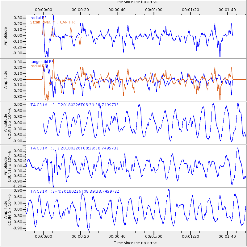
G31M Satah River, YT, CAN - Earthquake Result Viewer
*The percent match for this event was below the threshold and hence no stack was calculated.
| Earthquake location: |
New Guinea, Papua New Guinea |
| Earthquake latitude/longitude: |
-6.4/143.3 |
| Earthquake time(UTC): |
2018/02/26 (057) 08:26:59 GMT |
| Earthquake Depth: |
24 km |
| Earthquake Magnitude: |
6.0 Mww |
| Earthquake Catalog/Contributor: |
NEIC PDE/us |
|
| Network: |
TA USArray Transportable Network (new EarthScope stations) |
| Station: |
G31M Satah River, YT, CAN |
| Lat/Lon: |
66.92 N/134.27 W |
| Elevation: |
61 m |
|
| Distance: |
92.9 deg |
| Az: |
23.035 deg |
| Baz: |
260.566 deg |
| Ray Param: |
$rayparam |
*The percent match for this event was below the threshold and hence was not used in the summary stack. |
|
| Radial Match: |
72.34994 % |
| Radial Bump: |
355 |
| Transverse Match: |
65.10096 % |
| Transverse Bump: |
384 |
| SOD ConfigId: |
13570011 |
| Insert Time: |
2019-04-29 20:54:56.884 +0000 |
| GWidth: |
2.5 |
| Max Bumps: |
400 |
| Tol: |
0.001 |
|
Signal To Noise
| Channel | StoN | STA | LTA |
| TA:G31M: :BHZ:20180226T08:39:38.749973Z | 1.4431076 | 4.1221713E-7 | 2.8564546E-7 |
| TA:G31M: :BHN:20180226T08:39:38.749973Z | 1.0140201 | 2.7670168E-7 | 2.7287592E-7 |
| TA:G31M: :BHE:20180226T08:39:38.749973Z | 1.3548857 | 4.9717016E-7 | 3.6694624E-7 |
| Arrivals |
| Ps | |
| PpPs | |
| PsPs/PpSs | |


