You are here: Home > Network List > TA - USArray Transportable Network (new EarthScope stations) Stations List
> Station Q17K Contact Creek, Katmai, AK, USA > Earthquake Result Viewer
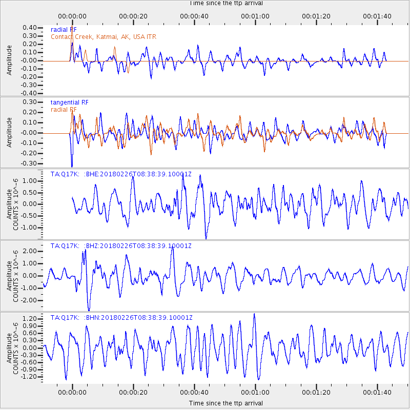
Q17K Contact Creek, Katmai, AK, USA - Earthquake Result Viewer
*The percent match for this event was below the threshold and hence no stack was calculated.
| Earthquake location: |
New Guinea, Papua New Guinea |
| Earthquake latitude/longitude: |
-6.4/143.3 |
| Earthquake time(UTC): |
2018/02/26 (057) 08:26:59 GMT |
| Earthquake Depth: |
24 km |
| Earthquake Magnitude: |
6.0 Mww |
| Earthquake Catalog/Contributor: |
NEIC PDE/us |
|
| Network: |
TA USArray Transportable Network (new EarthScope stations) |
| Station: |
Q17K Contact Creek, Katmai, AK, USA |
| Lat/Lon: |
58.26 N/155.89 W |
| Elevation: |
1165 m |
|
| Distance: |
80.7 deg |
| Az: |
27.887 deg |
| Baz: |
241.572 deg |
| Ray Param: |
$rayparam |
*The percent match for this event was below the threshold and hence was not used in the summary stack. |
|
| Radial Match: |
65.11792 % |
| Radial Bump: |
400 |
| Transverse Match: |
35.99549 % |
| Transverse Bump: |
400 |
| SOD ConfigId: |
13570011 |
| Insert Time: |
2019-04-29 20:55:13.991 +0000 |
| GWidth: |
2.5 |
| Max Bumps: |
400 |
| Tol: |
0.001 |
|
Signal To Noise
| Channel | StoN | STA | LTA |
| TA:Q17K: :BHZ:20180226T08:38:39.10001Z | 1.9982854 | 9.2504683E-7 | 4.6292027E-7 |
| TA:Q17K: :BHN:20180226T08:38:39.10001Z | 1.2404026 | 5.998805E-7 | 4.8361755E-7 |
| TA:Q17K: :BHE:20180226T08:38:39.10001Z | 0.6240521 | 2.6911582E-7 | 4.3123933E-7 |
| Arrivals |
| Ps | |
| PpPs | |
| PsPs/PpSs | |


