You are here: Home > Network List > CI - Caltech Regional Seismic Network Stations List
> Station IRM Iron Mountain Pumping Station, Eagle Mtn., CA, USA > Earthquake Result Viewer
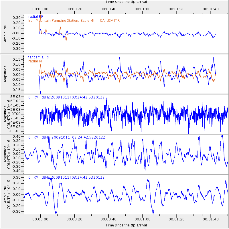
IRM Iron Mountain Pumping Station, Eagle Mtn., CA, USA - Earthquake Result Viewer
*The percent match for this event was below the threshold and hence no stack was calculated.
| Earthquake location: |
Southeast Of Loyalty Islands |
| Earthquake latitude/longitude: |
-22.0/170.2 |
| Earthquake time(UTC): |
2009/10/11 (284) 03:12:13 GMT |
| Earthquake Depth: |
10 km |
| Earthquake Magnitude: |
5.7 MB, 5.5 MS, 6.0 MW, 5.9 MW |
| Earthquake Catalog/Contributor: |
WHDF/NEIC |
|
| Network: |
CI Caltech Regional Seismic Network |
| Station: |
IRM Iron Mountain Pumping Station, Eagle Mtn., CA, USA |
| Lat/Lon: |
34.16 N/115.15 W |
| Elevation: |
567 m |
|
| Distance: |
90.2 deg |
| Az: |
53.083 deg |
| Baz: |
243.479 deg |
| Ray Param: |
$rayparam |
*The percent match for this event was below the threshold and hence was not used in the summary stack. |
|
| Radial Match: |
55.029305 % |
| Radial Bump: |
395 |
| Transverse Match: |
54.91839 % |
| Transverse Bump: |
364 |
| SOD ConfigId: |
2622 |
| Insert Time: |
2010-02-26 01:49:59.359 +0000 |
| GWidth: |
2.5 |
| Max Bumps: |
400 |
| Tol: |
0.001 |
|
Signal To Noise
| Channel | StoN | STA | LTA |
| CI:IRM: :BHN:20091011T03:24:42.532012Z | 1.1239607 | 1.12119544E-7 | 9.975397E-8 |
| CI:IRM: :BHE:20091011T03:24:42.532012Z | 0.8235466 | 8.593241E-8 | 1.0434432E-7 |
| CI:IRM: :BHZ:20091011T03:24:42.532012Z | 1.1374518 | 2.4790165E-9 | 2.1794475E-9 |
| Arrivals |
| Ps | |
| PpPs | |
| PsPs/PpSs | |


