You are here: Home > Network List > TA - USArray Transportable Network (new EarthScope stations) Stations List
> Station A36M Sachs Harbour, NT, CAN > Earthquake Result Viewer
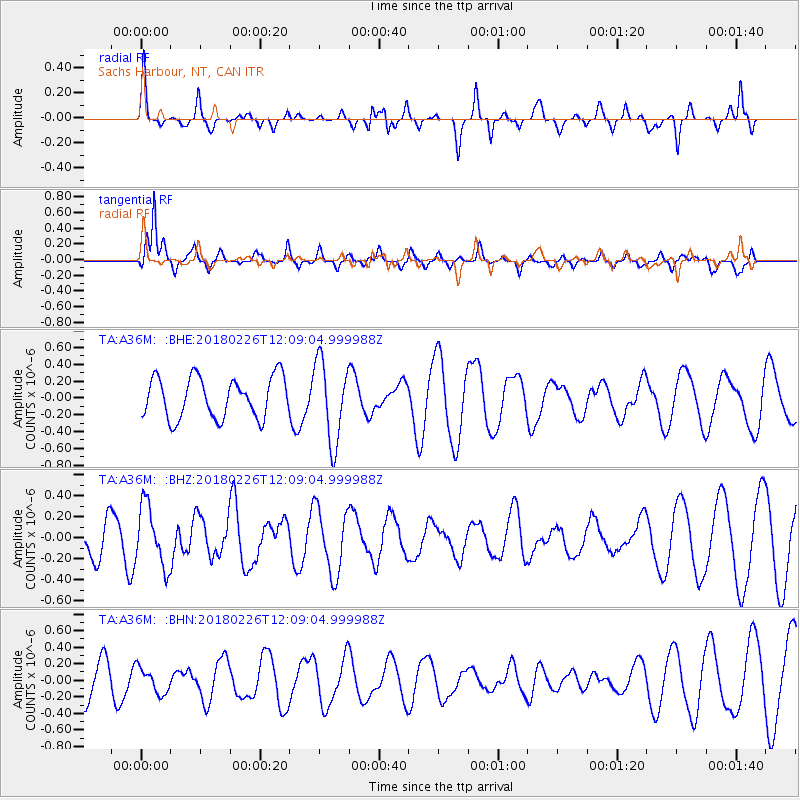
A36M Sachs Harbour, NT, CAN - Earthquake Result Viewer
*The percent match for this event was below the threshold and hence no stack was calculated.
| Earthquake location: |
New Guinea, Papua New Guinea |
| Earthquake latitude/longitude: |
-6.5/143.6 |
| Earthquake time(UTC): |
2018/02/26 (057) 11:56:07 GMT |
| Earthquake Depth: |
13 km |
| Earthquake Magnitude: |
5.7 Mww |
| Earthquake Catalog/Contributor: |
NEIC PDE/us |
|
| Network: |
TA USArray Transportable Network (new EarthScope stations) |
| Station: |
A36M Sachs Harbour, NT, CAN |
| Lat/Lon: |
71.99 N/125.25 W |
| Elevation: |
32 m |
|
| Distance: |
96.5 deg |
| Az: |
18.244 deg |
| Baz: |
269.122 deg |
| Ray Param: |
$rayparam |
*The percent match for this event was below the threshold and hence was not used in the summary stack. |
|
| Radial Match: |
26.344252 % |
| Radial Bump: |
252 |
| Transverse Match: |
86.85623 % |
| Transverse Bump: |
356 |
| SOD ConfigId: |
13570011 |
| Insert Time: |
2019-04-29 20:58:08.736 +0000 |
| GWidth: |
2.5 |
| Max Bumps: |
400 |
| Tol: |
0.001 |
|
Signal To Noise
| Channel | StoN | STA | LTA |
| TA:A36M: :BHZ:20180226T12:09:04.999988Z | 1.2585822 | 2.9118368E-7 | 2.3135848E-7 |
| TA:A36M: :BHN:20180226T12:09:04.999988Z | 0.48221758 | 1.5201663E-7 | 3.152449E-7 |
| TA:A36M: :BHE:20180226T12:09:04.999988Z | 1.9844154 | 4.819156E-7 | 2.4285018E-7 |
| Arrivals |
| Ps | |
| PpPs | |
| PsPs/PpSs | |


